You are here: Home > Network List > AZ - ANZA Regional Network Stations List
> Station SMER AZ.SMER > Earthquake Result Viewer
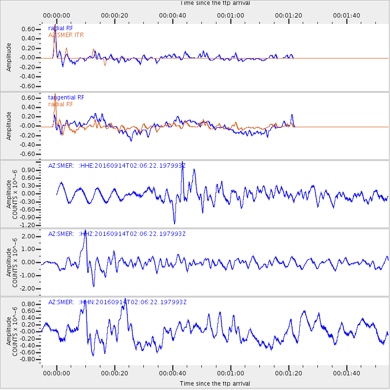
SMER AZ.SMER - Earthquake Result Viewer
*The percent match for this event was below the threshold and hence no stack was calculated.
| Earthquake location: |
Northern Colombia |
| Earthquake latitude/longitude: |
7.3/-76.1 |
| Earthquake time(UTC): |
2016/09/14 (258) 01:58:30 GMT |
| Earthquake Depth: |
10 km |
| Earthquake Magnitude: |
5.9 MWP |
| Earthquake Catalog/Contributor: |
NEIC PDE/NEIC COMCAT |
|
| Network: |
AZ ANZA Regional Network |
| Station: |
SMER AZ.SMER |
| Lat/Lon: |
33.46 N/117.17 W |
| Elevation: |
355 m |
|
| Distance: |
46.0 deg |
| Az: |
310.22 deg |
| Baz: |
115.04 deg |
| Ray Param: |
$rayparam |
*The percent match for this event was below the threshold and hence was not used in the summary stack. |
|
| Radial Match: |
76.91124 % |
| Radial Bump: |
312 |
| Transverse Match: |
58.76012 % |
| Transverse Bump: |
400 |
| SOD ConfigId: |
11737051 |
| Insert Time: |
2019-04-25 12:34:52.649 +0000 |
| GWidth: |
2.5 |
| Max Bumps: |
400 |
| Tol: |
0.001 |
|
Signal To Noise
| Channel | StoN | STA | LTA |
| AZ:SMER: :HHZ:20160914T02:06:22.197993Z | 3.6054502 | 3.4078695E-7 | 9.451995E-8 |
| AZ:SMER: :HHN:20160914T02:06:22.197993Z | 1.2026904 | 1.4740601E-7 | 1.2256356E-7 |
| AZ:SMER: :HHE:20160914T02:06:22.197993Z | 0.8133051 | 1.6321346E-7 | 2.0067925E-7 |
| Arrivals |
| Ps | |
| PpPs | |
| PsPs/PpSs | |


