You are here: Home > Network List > TA - USArray Transportable Network (new EarthScope stations) Stations List
> Station J05D Fort Rock, OR, USA > Earthquake Result Viewer
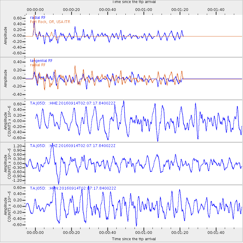
J05D Fort Rock, OR, USA - Earthquake Result Viewer
*The percent match for this event was below the threshold and hence no stack was calculated.
| Earthquake location: |
Northern Colombia |
| Earthquake latitude/longitude: |
7.3/-76.1 |
| Earthquake time(UTC): |
2016/09/14 (258) 01:58:30 GMT |
| Earthquake Depth: |
10 km |
| Earthquake Magnitude: |
5.9 MWP |
| Earthquake Catalog/Contributor: |
NEIC PDE/NEIC COMCAT |
|
| Network: |
TA USArray Transportable Network (new EarthScope stations) |
| Station: |
J05D Fort Rock, OR, USA |
| Lat/Lon: |
43.28 N/121.23 W |
| Elevation: |
1541 m |
|
| Distance: |
53.3 deg |
| Az: |
319.797 deg |
| Baz: |
118.739 deg |
| Ray Param: |
$rayparam |
*The percent match for this event was below the threshold and hence was not used in the summary stack. |
|
| Radial Match: |
63.58048 % |
| Radial Bump: |
400 |
| Transverse Match: |
46.148865 % |
| Transverse Bump: |
384 |
| SOD ConfigId: |
11737051 |
| Insert Time: |
2019-04-25 12:42:19.500 +0000 |
| GWidth: |
2.5 |
| Max Bumps: |
400 |
| Tol: |
0.001 |
|
Signal To Noise
| Channel | StoN | STA | LTA |
| TA:J05D: :HHZ:20160914T02:07:17.840022Z | 2.2306483 | 2.6443468E-7 | 1.18546104E-7 |
| TA:J05D: :HHN:20160914T02:07:17.840022Z | 0.7823969 | 1.09734025E-7 | 1.4025365E-7 |
| TA:J05D: :HHE:20160914T02:07:17.840022Z | 1.4308614 | 3.205382E-7 | 2.2401765E-7 |
| Arrivals |
| Ps | |
| PpPs | |
| PsPs/PpSs | |


