You are here: Home > Network List > TA - USArray Transportable Network (new EarthScope stations) Stations List
> Station J20K Nowitna River, AK, USA > Earthquake Result Viewer
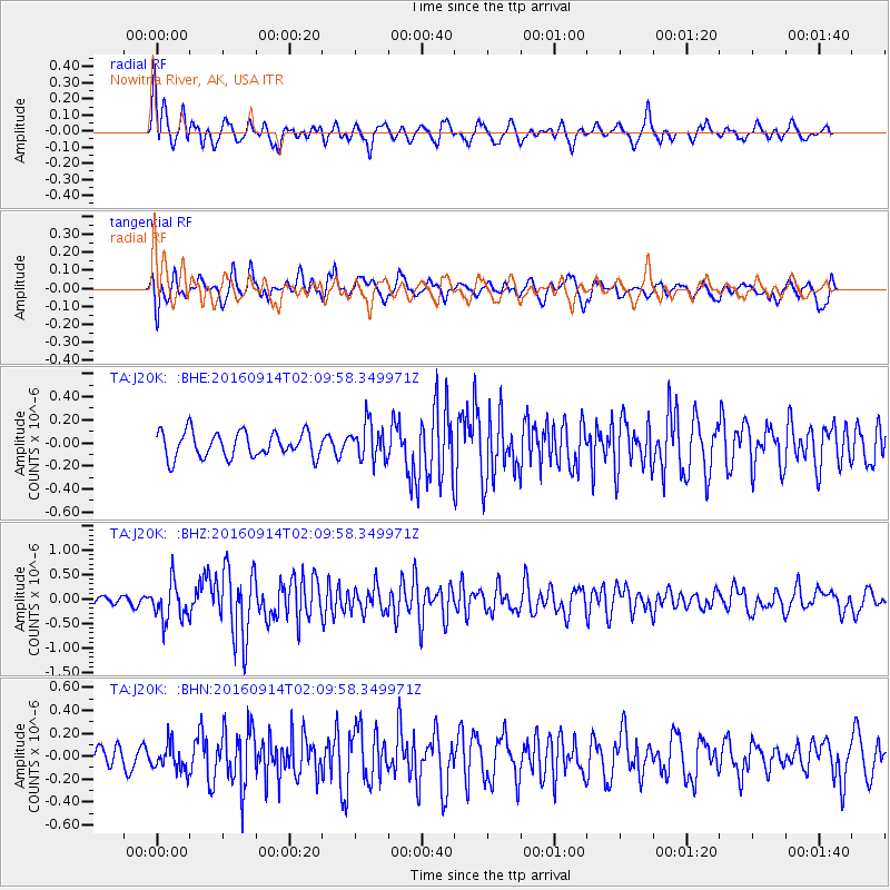
J20K Nowitna River, AK, USA - Earthquake Result Viewer
*The percent match for this event was below the threshold and hence no stack was calculated.
| Earthquake location: |
Northern Colombia |
| Earthquake latitude/longitude: |
7.3/-76.1 |
| Earthquake time(UTC): |
2016/09/14 (258) 01:58:30 GMT |
| Earthquake Depth: |
10 km |
| Earthquake Magnitude: |
5.9 MWP |
| Earthquake Catalog/Contributor: |
NEIC PDE/NEIC COMCAT |
|
| Network: |
TA USArray Transportable Network (new EarthScope stations) |
| Station: |
J20K Nowitna River, AK, USA |
| Lat/Lon: |
64.18 N/154.15 W |
| Elevation: |
314 m |
|
| Distance: |
78.2 deg |
| Az: |
334.045 deg |
| Baz: |
97.584 deg |
| Ray Param: |
$rayparam |
*The percent match for this event was below the threshold and hence was not used in the summary stack. |
|
| Radial Match: |
64.71488 % |
| Radial Bump: |
400 |
| Transverse Match: |
61.035397 % |
| Transverse Bump: |
400 |
| SOD ConfigId: |
11737051 |
| Insert Time: |
2019-04-25 12:42:19.915 +0000 |
| GWidth: |
2.5 |
| Max Bumps: |
400 |
| Tol: |
0.001 |
|
Signal To Noise
| Channel | StoN | STA | LTA |
| TA:J20K: :BHZ:20160914T02:09:58.349971Z | 2.2520204 | 3.86144E-7 | 1.7146559E-7 |
| TA:J20K: :BHN:20160914T02:09:58.349971Z | 1.0778623 | 1.1587043E-7 | 1.0750021E-7 |
| TA:J20K: :BHE:20160914T02:09:58.349971Z | 1.4296668 | 1.5635096E-7 | 1.0936182E-7 |
| Arrivals |
| Ps | |
| PpPs | |
| PsPs/PpSs | |


