You are here: Home > Network List > AK - Alaska Regional Network Stations List
> Station CUT Chulitna, AK, USA > Earthquake Result Viewer
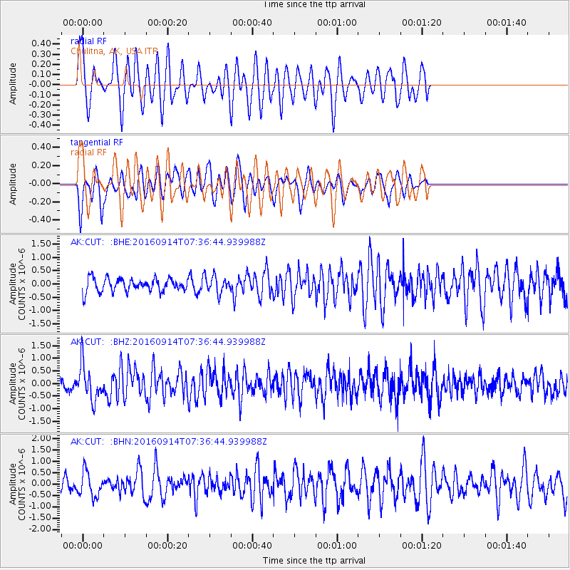
CUT Chulitna, AK, USA - Earthquake Result Viewer
*The percent match for this event was below the threshold and hence no stack was calculated.
| Earthquake location: |
Solomon Islands |
| Earthquake latitude/longitude: |
-9.4/159.1 |
| Earthquake time(UTC): |
2016/09/14 (258) 07:24:59 GMT |
| Earthquake Depth: |
10 km |
| Earthquake Magnitude: |
6.0 MWB |
| Earthquake Catalog/Contributor: |
NEIC PDE/NEIC COMCAT |
|
| Network: |
AK Alaska Regional Network |
| Station: |
CUT Chulitna, AK, USA |
| Lat/Lon: |
62.41 N/150.26 W |
| Elevation: |
574 m |
|
| Distance: |
81.5 deg |
| Az: |
21.335 deg |
| Baz: |
230.447 deg |
| Ray Param: |
$rayparam |
*The percent match for this event was below the threshold and hence was not used in the summary stack. |
|
| Radial Match: |
58.336414 % |
| Radial Bump: |
400 |
| Transverse Match: |
57.281178 % |
| Transverse Bump: |
346 |
| SOD ConfigId: |
11737051 |
| Insert Time: |
2019-04-25 12:46:03.580 +0000 |
| GWidth: |
2.5 |
| Max Bumps: |
400 |
| Tol: |
0.001 |
|
Signal To Noise
| Channel | StoN | STA | LTA |
| AK:CUT: :BHZ:20160914T07:36:44.939988Z | 4.241519 | 7.188958E-7 | 1.6949016E-7 |
| AK:CUT: :BHN:20160914T07:36:44.939988Z | 1.6046052 | 5.552492E-7 | 3.4603477E-7 |
| AK:CUT: :BHE:20160914T07:36:44.939988Z | 1.3216473 | 3.0846743E-7 | 2.333962E-7 |
| Arrivals |
| Ps | |
| PpPs | |
| PsPs/PpSs | |


