You are here: Home > Network List > TA - USArray Transportable Network (new EarthScope stations) Stations List
> Station D25K Kavik River, AK, USA > Earthquake Result Viewer
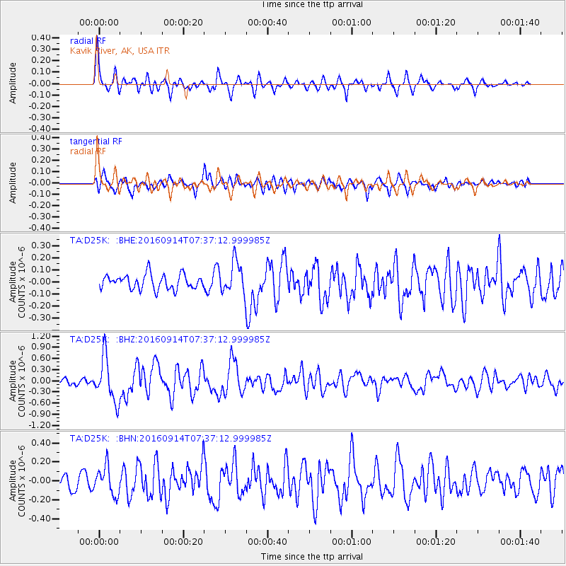
D25K Kavik River, AK, USA - Earthquake Result Viewer
*The percent match for this event was below the threshold and hence no stack was calculated.
| Earthquake location: |
Solomon Islands |
| Earthquake latitude/longitude: |
-9.4/159.1 |
| Earthquake time(UTC): |
2016/09/14 (258) 07:24:59 GMT |
| Earthquake Depth: |
10 km |
| Earthquake Magnitude: |
6.0 MWB |
| Earthquake Catalog/Contributor: |
NEIC PDE/NEIC COMCAT |
|
| Network: |
TA USArray Transportable Network (new EarthScope stations) |
| Station: |
D25K Kavik River, AK, USA |
| Lat/Lon: |
69.32 N/146.38 W |
| Elevation: |
770 m |
|
| Distance: |
87.0 deg |
| Az: |
16.828 deg |
| Baz: |
233.543 deg |
| Ray Param: |
$rayparam |
*The percent match for this event was below the threshold and hence was not used in the summary stack. |
|
| Radial Match: |
75.06918 % |
| Radial Bump: |
352 |
| Transverse Match: |
74.05937 % |
| Transverse Bump: |
400 |
| SOD ConfigId: |
11737051 |
| Insert Time: |
2019-04-25 12:51:56.874 +0000 |
| GWidth: |
2.5 |
| Max Bumps: |
400 |
| Tol: |
0.001 |
|
Signal To Noise
| Channel | StoN | STA | LTA |
| TA:D25K: :BHZ:20160914T07:37:12.999985Z | 7.031258 | 6.1271925E-7 | 8.71422E-8 |
| TA:D25K: :BHN:20160914T07:37:12.999985Z | 1.964727 | 1.536374E-7 | 7.8197836E-8 |
| TA:D25K: :BHE:20160914T07:37:12.999985Z | 3.1087587 | 1.8870192E-7 | 6.070009E-8 |
| Arrivals |
| Ps | |
| PpPs | |
| PsPs/PpSs | |


