You are here: Home > Network List > TA - USArray Transportable Network (new EarthScope stations) Stations List
> Station R32K Eaglecrest, AK, USA > Earthquake Result Viewer
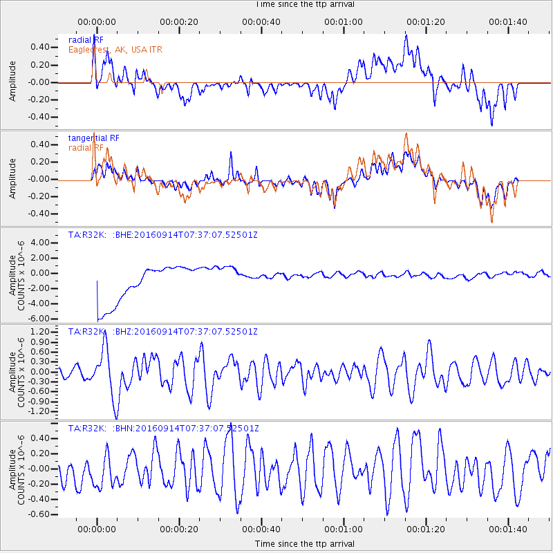
R32K Eaglecrest, AK, USA - Earthquake Result Viewer
*The percent match for this event was below the threshold and hence no stack was calculated.
| Earthquake location: |
Solomon Islands |
| Earthquake latitude/longitude: |
-9.4/159.1 |
| Earthquake time(UTC): |
2016/09/14 (258) 07:24:59 GMT |
| Earthquake Depth: |
10 km |
| Earthquake Magnitude: |
6.0 MWB |
| Earthquake Catalog/Contributor: |
NEIC PDE/NEIC COMCAT |
|
| Network: |
TA USArray Transportable Network (new EarthScope stations) |
| Station: |
R32K Eaglecrest, AK, USA |
| Lat/Lon: |
58.27 N/134.52 W |
| Elevation: |
386 m |
|
| Distance: |
85.9 deg |
| Az: |
29.028 deg |
| Baz: |
244.987 deg |
| Ray Param: |
$rayparam |
*The percent match for this event was below the threshold and hence was not used in the summary stack. |
|
| Radial Match: |
10.186718 % |
| Radial Bump: |
400 |
| Transverse Match: |
13.7620535 % |
| Transverse Bump: |
400 |
| SOD ConfigId: |
11737051 |
| Insert Time: |
2019-04-25 12:53:12.447 +0000 |
| GWidth: |
2.5 |
| Max Bumps: |
400 |
| Tol: |
0.001 |
|
Signal To Noise
| Channel | StoN | STA | LTA |
| TA:R32K: :BHZ:20160914T07:37:07.52501Z | 3.5684292 | 7.877983E-7 | 2.2076892E-7 |
| TA:R32K: :BHN:20160914T07:37:07.52501Z | 0.84950054 | 2.8109963E-7 | 3.308999E-7 |
| TA:R32K: :BHE:20160914T07:37:07.52501Z | 0.7467884 | 1.6818294E-6 | 2.252083E-6 |
| Arrivals |
| Ps | |
| PpPs | |
| PsPs/PpSs | |


