You are here: Home > Network List > UW - Pacific Northwest Regional Seismic Network Stations List
> Station LCCR Mulino, OR, USA > Earthquake Result Viewer
LCCR Mulino, OR, USA - Earthquake Result Viewer
*The percent match for this event was below the threshold and hence no stack was calculated.
| Earthquake location: |
Solomon Islands |
| Earthquake latitude/longitude: |
-9.4/159.1 |
| Earthquake time(UTC): |
2016/09/14 (258) 07:24:59 GMT |
| Earthquake Depth: |
10 km |
| Earthquake Magnitude: |
6.0 MWB |
| Earthquake Catalog/Contributor: |
NEIC PDE/NEIC COMCAT |
|
| Network: |
UW Pacific Northwest Regional Seismic Network |
| Station: |
LCCR Mulino, OR, USA |
| Lat/Lon: |
45.21 N/122.48 W |
| Elevation: |
273 m |
|
| Distance: |
88.5 deg |
| Az: |
43.843 deg |
| Baz: |
255.224 deg |
| Ray Param: |
$rayparam |
*The percent match for this event was below the threshold and hence was not used in the summary stack. |
|
| Radial Match: |
60.210846 % |
| Radial Bump: |
400 |
| Transverse Match: |
62.812317 % |
| Transverse Bump: |
400 |
| SOD ConfigId: |
11737051 |
| Insert Time: |
2019-04-25 12:53:43.126 +0000 |
| GWidth: |
2.5 |
| Max Bumps: |
400 |
| Tol: |
0.001 |
|
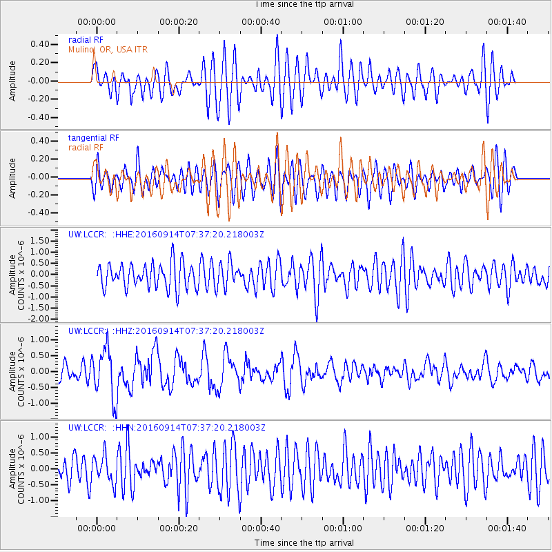
Signal To Noise
| Channel | StoN | STA | LTA |
| UW:LCCR: :HHZ:20160914T07:37:20.218003Z | 3.4660861 | 8.08309E-7 | 2.332051E-7 |
| UW:LCCR: :HHN:20160914T07:37:20.218003Z | 1.1142046 | 4.3232262E-7 | 3.8801005E-7 |
| UW:LCCR: :HHE:20160914T07:37:20.218003Z | 0.8948116 | 4.942133E-7 | 5.5230987E-7 |
| Arrivals |
| Ps | |
| PpPs | |
| PsPs/PpSs | |


