You are here: Home > Network List > UW - Pacific Northwest Regional Seismic Network Stations List
> Station LEBA Lebam, WA, USA > Earthquake Result Viewer
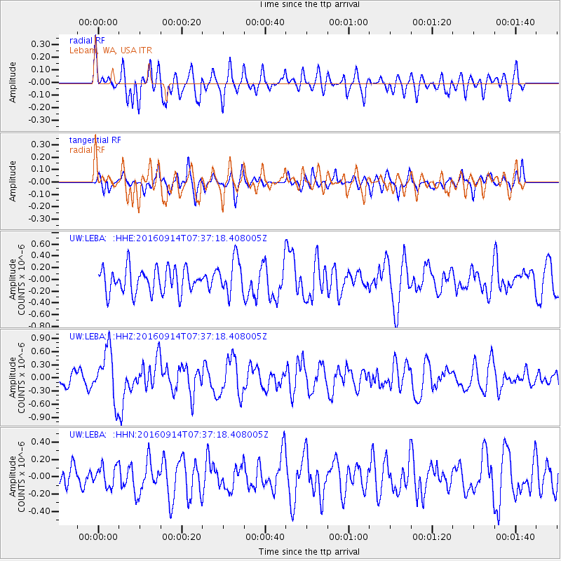
LEBA Lebam, WA, USA - Earthquake Result Viewer
*The percent match for this event was below the threshold and hence no stack was calculated.
| Earthquake location: |
Solomon Islands |
| Earthquake latitude/longitude: |
-9.4/159.1 |
| Earthquake time(UTC): |
2016/09/14 (258) 07:24:59 GMT |
| Earthquake Depth: |
10 km |
| Earthquake Magnitude: |
6.0 MWB |
| Earthquake Catalog/Contributor: |
NEIC PDE/NEIC COMCAT |
|
| Network: |
UW Pacific Northwest Regional Seismic Network |
| Station: |
LEBA Lebam, WA, USA |
| Lat/Lon: |
46.55 N/123.56 W |
| Elevation: |
73 m |
|
| Distance: |
88.1 deg |
| Az: |
42.35 deg |
| Baz: |
254.403 deg |
| Ray Param: |
$rayparam |
*The percent match for this event was below the threshold and hence was not used in the summary stack. |
|
| Radial Match: |
69.14265 % |
| Radial Bump: |
400 |
| Transverse Match: |
60.138397 % |
| Transverse Bump: |
400 |
| SOD ConfigId: |
11737051 |
| Insert Time: |
2019-04-25 12:53:43.964 +0000 |
| GWidth: |
2.5 |
| Max Bumps: |
400 |
| Tol: |
0.001 |
|
Signal To Noise
| Channel | StoN | STA | LTA |
| UW:LEBA: :HHZ:20160914T07:37:18.408005Z | 4.733803 | 6.0139814E-7 | 1.2704335E-7 |
| UW:LEBA: :HHN:20160914T07:37:18.408005Z | 0.7581714 | 1.2229542E-7 | 1.6130313E-7 |
| UW:LEBA: :HHE:20160914T07:37:18.408005Z | 1.6144211 | 3.3453227E-7 | 2.07215E-7 |
| Arrivals |
| Ps | |
| PpPs | |
| PsPs/PpSs | |


