LTX Lajitas, Texas, USA - Earthquake Result Viewer
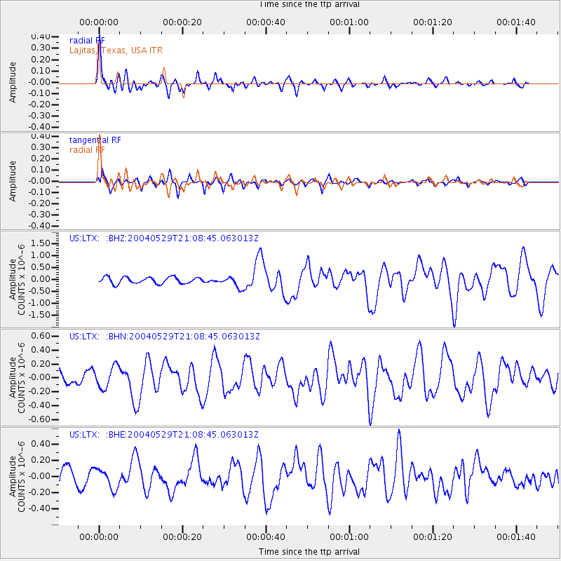
Earthquake location: Off East Coast Of Honshu, Japan
Earthquake latitude/longitude: 34.3/141.4
Earthquake time(UTC): 2004/05/29 (150) 20:56:09 GMT
Earthquake Depth: 16 km
Earthquake Magnitude: 5.6 MB, 6.6 MS, 6.5 MW, 6.3 MW
Earthquake Catalog/Contributor: WHDF/NEIC
Network: US United States National Seismic Network
Station: LTX Lajitas, Texas, USA
Lat/Lon: 29.33 N/103.67 W
Elevation: 1013 m
Distance: 91.8 deg
Az: 52.395 deg
Baz: 311.275 deg
Ray Param: 0.04154964
Estimated Moho Depth: 34.75 km
Estimated Crust Vp/Vs: 1.90
Assumed Crust Vp: 6.419 km/s
Estimated Crust Vs: 3.383 km/s
Estimated Crust Poisson's Ratio: 0.31
Radial Match: 84.20165 %
Radial Bump: 400
Transverse Match: 74.90296 %
Transverse Bump: 400
SOD ConfigId: 110165
Insert Time: 2010-03-05 07:00:57.557 +0000
GWidth: 2.5
Max Bumps: 400
Tol: 0.001

Signal To Noise

ChannelStoNSTALTA
US:LTX: :BHN:20040529T21:08:45.063013Z1.71195231.5982026E-79.335556E-8
US:LTX: :BHE:20040529T21:08:45.063013Z1.36557041.2282686E-78.9945466E-8
US:LTX: :BHZ:20040529T21:08:45.063013Z1.85097612.4594752E-71.328745E-7
Arrivals
Ps5.0 SECOND
PpPs15 SECOND
PsPs/PpSs20 SECOND