
LTX Lajitas, Texas, USA - Earthquake Result Viewer
| ||||||||||||||||||
| ||||||||||||||||||
| ||||||||||||||||||
|
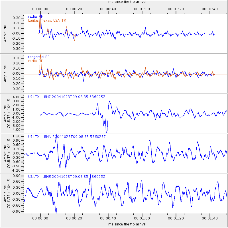
Signal To Noise
| Channel | StoN | STA | LTA |
| US:LTX: :BHN:20041023T09:08:35.536025Z | 2.7568614 | 1.9266488E-7 | 6.9885594E-8 |
| US:LTX: :BHE:20041023T09:08:35.536025Z | 0.9950219 | 1.7996086E-7 | 1.808612E-7 |
| US:LTX: :BHZ:20041023T09:08:35.536025Z | 4.0299745 | 9.043415E-7 | 2.2440379E-7 |
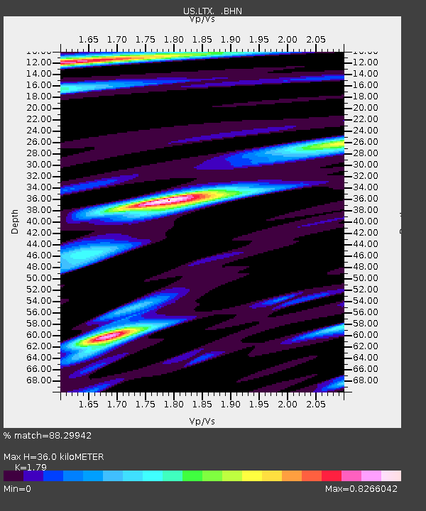
| Arrivals | |
| Ps | 4.5 SECOND |
| PpPs | 15 SECOND |
| PsPs/PpSs | 20 SECOND |

