You are here: Home > Network List > UW - Pacific Northwest Regional Seismic Network Stations List
> Station MRBL Marblemount, WA, USA > Earthquake Result Viewer
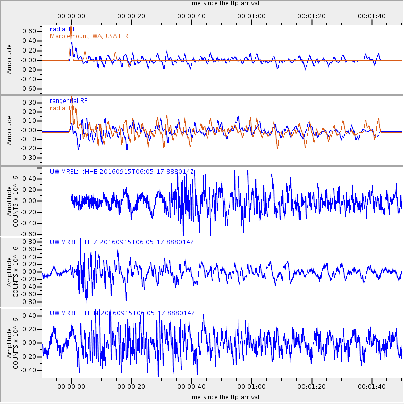
MRBL Marblemount, WA, USA - Earthquake Result Viewer
*The percent match for this event was below the threshold and hence no stack was calculated.
| Earthquake location: |
Nicaragua |
| Earthquake latitude/longitude: |
12.4/-86.6 |
| Earthquake time(UTC): |
2016/09/15 (259) 05:57:24 GMT |
| Earthquake Depth: |
10 km |
| Earthquake Magnitude: |
5.7 mww |
| Earthquake Catalog/Contributor: |
NEIC PDE/us |
|
| Network: |
UW Pacific Northwest Regional Seismic Network |
| Station: |
MRBL Marblemount, WA, USA |
| Lat/Lon: |
48.52 N/121.48 W |
| Elevation: |
75 m |
|
| Distance: |
46.1 deg |
| Az: |
328.208 deg |
| Baz: |
129.284 deg |
| Ray Param: |
$rayparam |
*The percent match for this event was below the threshold and hence was not used in the summary stack. |
|
| Radial Match: |
60.901524 % |
| Radial Bump: |
400 |
| Transverse Match: |
52.277588 % |
| Transverse Bump: |
400 |
| SOD ConfigId: |
11737051 |
| Insert Time: |
2019-04-25 13:02:13.156 +0000 |
| GWidth: |
2.5 |
| Max Bumps: |
400 |
| Tol: |
0.001 |
|
Signal To Noise
| Channel | StoN | STA | LTA |
| UW:MRBL: :HHZ:20160915T06:05:17.888014Z | 3.79608 | 2.980149E-7 | 7.8505956E-8 |
| UW:MRBL: :HHN:20160915T06:05:17.888014Z | 1.329564 | 1.6800546E-7 | 1.2636131E-7 |
| UW:MRBL: :HHE:20160915T06:05:17.888014Z | 1.5506333 | 1.4758076E-7 | 9.5174514E-8 |
| Arrivals |
| Ps | |
| PpPs | |
| PsPs/PpSs | |


