LTX Lajitas, Texas, USA - Earthquake Result Viewer
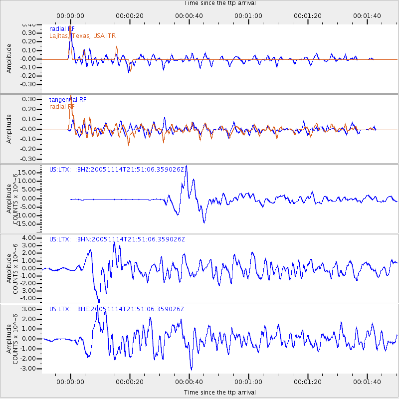
Earthquake location: Off East Coast Of Honshu, Japan
Earthquake latitude/longitude: 38.1/144.9
Earthquake time(UTC): 2005/11/14 (318) 21:38:51 GMT
Earthquake Depth: 11 km
Earthquake Magnitude: 6.7 MB, 6.8 MS, 7.0 MW, 6.9 MW
Earthquake Catalog/Contributor: WHDF/NEIC
Network: US United States National Seismic Network
Station: LTX Lajitas, Texas, USA
Lat/Lon: 29.33 N/103.67 W
Elevation: 1013 m
Distance: 87.3 deg
Az: 54.459 deg
Baz: 312.682 deg
Ray Param: 0.043448355
Estimated Moho Depth: 12.0 km
Estimated Crust Vp/Vs: 1.60
Assumed Crust Vp: 6.419 km/s
Estimated Crust Vs: 4.012 km/s
Estimated Crust Poisson's Ratio: 0.18
Radial Match: 93.99156 %
Radial Bump: 400
Transverse Match: 90.687325 %
Transverse Bump: 400
SOD ConfigId: 2448
Insert Time: 2010-03-05 07:01:51.626 +0000
GWidth: 2.5
Max Bumps: 400
Tol: 0.001

Signal To Noise

ChannelStoNSTALTA
US:LTX: :BHN:20051114T21:51:06.359026Z2.01718852.7600083E-71.3682451E-7
US:LTX: :BHE:20051114T21:51:06.359026Z4.75965362.789007E-75.859685E-8
US:LTX: :BHZ:20051114T21:51:06.359026Z12.283661.6475942E-61.3412894E-7
Arrivals
Ps1.2 SECOND
PpPs4.7 SECOND
PsPs/PpSs5.9 SECOND