You are here: Home > Network List > TA - USArray Transportable Network (new EarthScope stations) Stations List
> Station D23K Nanushuk River, AK USA > Earthquake Result Viewer
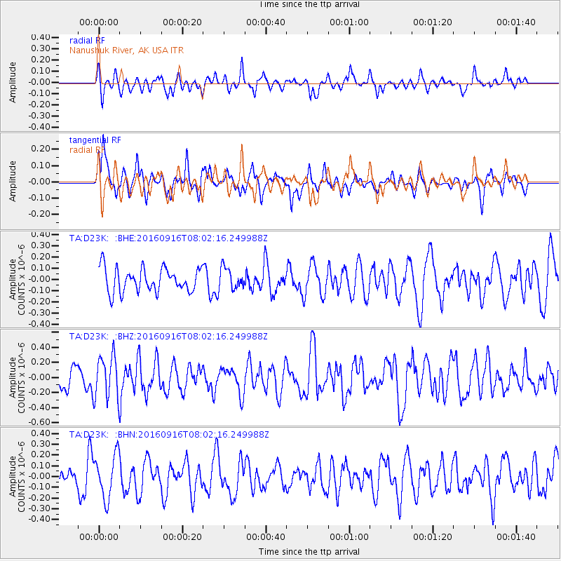
D23K Nanushuk River, AK USA - Earthquake Result Viewer
*The percent match for this event was below the threshold and hence no stack was calculated.
| Earthquake location: |
Mindanao, Philippines |
| Earthquake latitude/longitude: |
5.7/125.5 |
| Earthquake time(UTC): |
2016/09/16 (260) 07:50:46 GMT |
| Earthquake Depth: |
193 km |
| Earthquake Magnitude: |
5.4 Mww |
| Earthquake Catalog/Contributor: |
NEIC PDE/us |
|
| Network: |
TA USArray Transportable Network (new EarthScope stations) |
| Station: |
D23K Nanushuk River, AK USA |
| Lat/Lon: |
68.97 N/150.68 W |
| Elevation: |
406 m |
|
| Distance: |
82.5 deg |
| Az: |
21.225 deg |
| Baz: |
266.274 deg |
| Ray Param: |
$rayparam |
*The percent match for this event was below the threshold and hence was not used in the summary stack. |
|
| Radial Match: |
52.43448 % |
| Radial Bump: |
400 |
| Transverse Match: |
53.84829 % |
| Transverse Bump: |
400 |
| SOD ConfigId: |
11737051 |
| Insert Time: |
2019-04-25 13:11:09.819 +0000 |
| GWidth: |
2.5 |
| Max Bumps: |
400 |
| Tol: |
0.001 |
|
Signal To Noise
| Channel | StoN | STA | LTA |
| TA:D23K: :BHZ:20160916T08:02:16.249988Z | 1.8740585 | 2.794315E-7 | 1.49105E-7 |
| TA:D23K: :BHN:20160916T08:02:16.249988Z | 1.716728 | 2.0817302E-7 | 1.2126151E-7 |
| TA:D23K: :BHE:20160916T08:02:16.249988Z | 0.87809664 | 9.239483E-8 | 1.0522171E-7 |
| Arrivals |
| Ps | |
| PpPs | |
| PsPs/PpSs | |


