
LTX Lajitas, Texas, USA - Earthquake Result Viewer
| ||||||||||||||||||
| ||||||||||||||||||
| ||||||||||||||||||
|
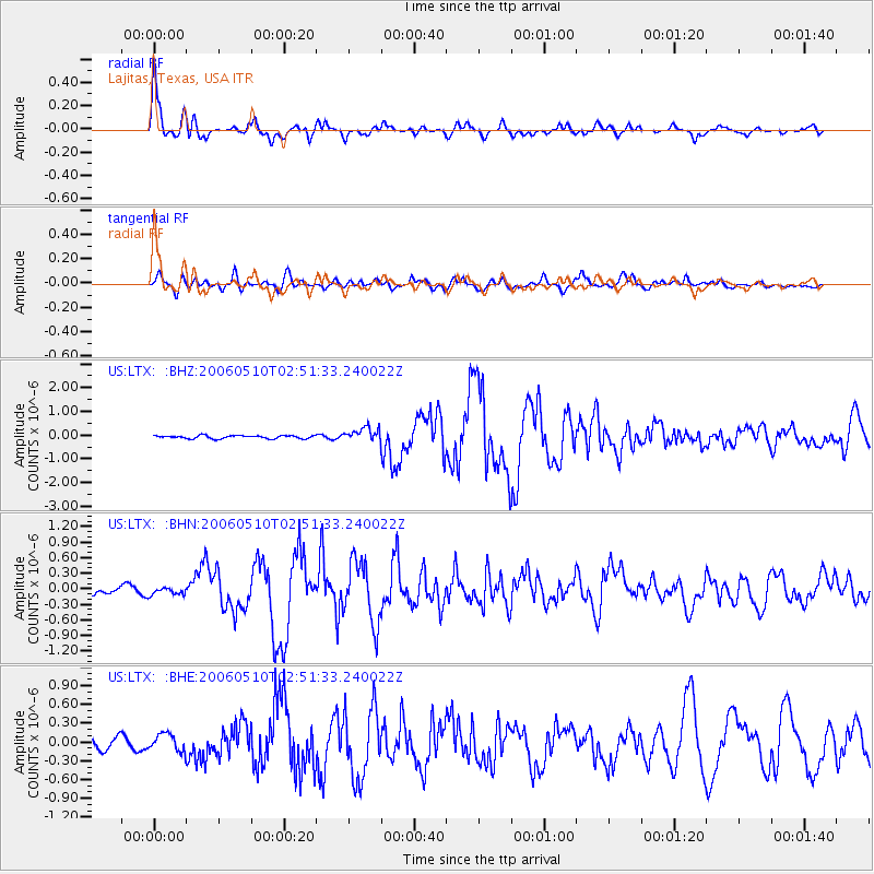
Signal To Noise
| Channel | StoN | STA | LTA |
| US:LTX: :BHN:20060510T02:51:33.240022Z | 1.0975046 | 6.95637E-8 | 6.338351E-8 |
| US:LTX: :BHE:20060510T02:51:33.240022Z | 1.0978867 | 1.3567576E-7 | 1.2357903E-7 |
| US:LTX: :BHZ:20060510T02:51:33.240022Z | 4.5565195 | 2.8677664E-7 | 6.293765E-8 |
| Arrivals | |
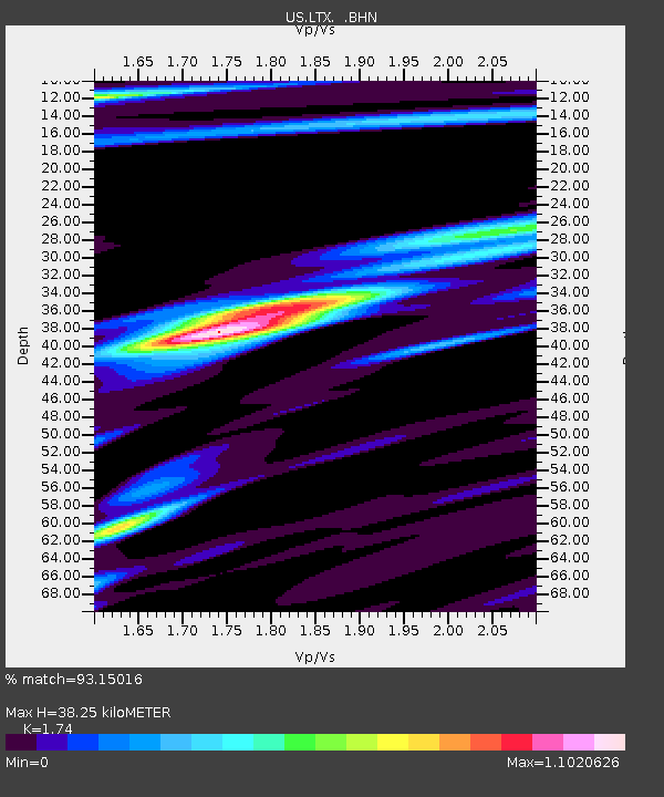
| Ps | 4.7 SECOND |
| PpPs | 15 SECOND |
| PsPs/PpSs | 20 SECOND |

