You are here: Home > Network List > AK - Alaska Regional Network Stations List
> Station MDM Murphy Dome > Earthquake Result Viewer
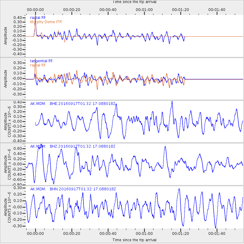
MDM Murphy Dome - Earthquake Result Viewer
*The percent match for this event was below the threshold and hence no stack was calculated.
| Earthquake location: |
Near North Coast Of Irian Jaya |
| Earthquake latitude/longitude: |
-2.1/140.6 |
| Earthquake time(UTC): |
2016/09/17 (261) 01:20:18 GMT |
| Earthquake Depth: |
10 km |
| Earthquake Magnitude: |
5.9 MWP |
| Earthquake Catalog/Contributor: |
NEIC PDE/NEIC COMCAT |
|
| Network: |
AK Alaska Regional Network |
| Station: |
MDM Murphy Dome |
| Lat/Lon: |
64.96 N/148.23 W |
| Elevation: |
634 m |
|
| Distance: |
84.0 deg |
| Az: |
23.897 deg |
| Baz: |
252.018 deg |
| Ray Param: |
$rayparam |
*The percent match for this event was below the threshold and hence was not used in the summary stack. |
|
| Radial Match: |
64.53176 % |
| Radial Bump: |
400 |
| Transverse Match: |
45.51114 % |
| Transverse Bump: |
400 |
| SOD ConfigId: |
11737051 |
| Insert Time: |
2019-04-25 13:17:05.241 +0000 |
| GWidth: |
2.5 |
| Max Bumps: |
400 |
| Tol: |
0.001 |
|
Signal To Noise
| Channel | StoN | STA | LTA |
| AK:MDM: :BHZ:20160917T01:32:17.088018Z | 8.418265 | 5.463799E-7 | 6.49041E-8 |
| AK:MDM: :BHN:20160917T01:32:17.088018Z | 1.3018701 | 1.1234771E-7 | 8.629718E-8 |
| AK:MDM: :BHE:20160917T01:32:17.088018Z | 1.8346444 | 1.6628475E-7 | 9.063596E-8 |
| Arrivals |
| Ps | |
| PpPs | |
| PsPs/PpSs | |


