You are here: Home > Network List > TA - USArray Transportable Network (new EarthScope stations) Stations List
> Station R17K Ugashik Creek, AK, USA > Earthquake Result Viewer
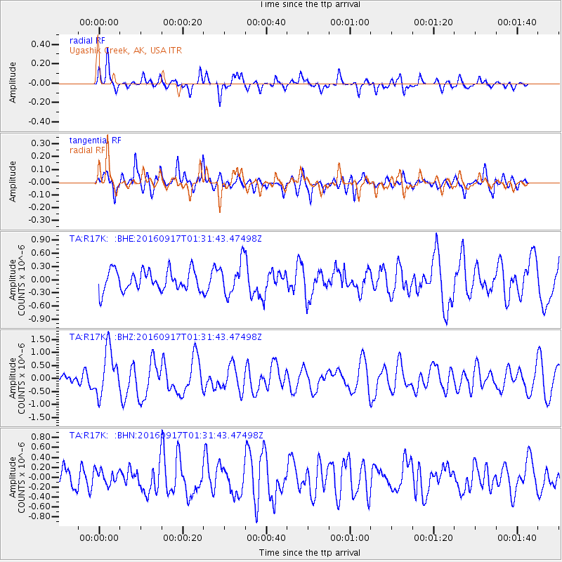
R17K Ugashik Creek, AK, USA - Earthquake Result Viewer
*The percent match for this event was below the threshold and hence no stack was calculated.
| Earthquake location: |
Near North Coast Of Irian Jaya |
| Earthquake latitude/longitude: |
-2.1/140.6 |
| Earthquake time(UTC): |
2016/09/17 (261) 01:20:18 GMT |
| Earthquake Depth: |
10 km |
| Earthquake Magnitude: |
5.9 MWP |
| Earthquake Catalog/Contributor: |
NEIC PDE/NEIC COMCAT |
|
| Network: |
TA USArray Transportable Network (new EarthScope stations) |
| Station: |
R17K Ugashik Creek, AK, USA |
| Lat/Lon: |
57.64 N/156.39 W |
| Elevation: |
273 m |
|
| Distance: |
77.7 deg |
| Az: |
29.38 deg |
| Baz: |
245.727 deg |
| Ray Param: |
$rayparam |
*The percent match for this event was below the threshold and hence was not used in the summary stack. |
|
| Radial Match: |
72.405014 % |
| Radial Bump: |
400 |
| Transverse Match: |
63.899742 % |
| Transverse Bump: |
400 |
| SOD ConfigId: |
11737051 |
| Insert Time: |
2019-04-25 13:21:05.777 +0000 |
| GWidth: |
2.5 |
| Max Bumps: |
400 |
| Tol: |
0.001 |
|
Signal To Noise
| Channel | StoN | STA | LTA |
| TA:R17K: :BHZ:20160917T01:31:43.47498Z | 4.2497005 | 8.998841E-7 | 2.1175235E-7 |
| TA:R17K: :BHN:20160917T01:31:43.47498Z | 0.48388276 | 1.3907699E-7 | 2.8741877E-7 |
| TA:R17K: :BHE:20160917T01:31:43.47498Z | 1.731862 | 3.963998E-7 | 2.2888649E-7 |
| Arrivals |
| Ps | |
| PpPs | |
| PsPs/PpSs | |


