You are here: Home > Network List > US - United States National Seismic Network Stations List
> Station LTX Lajitas, Texas, USA > Earthquake Result Viewer
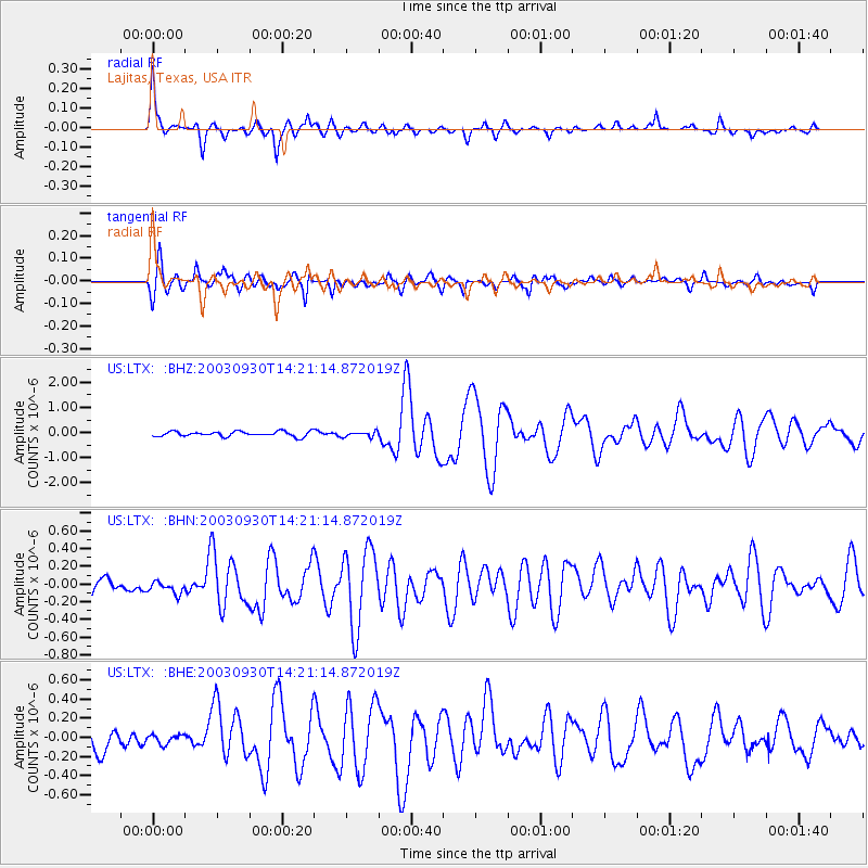
LTX Lajitas, Texas, USA - Earthquake Result Viewer
*The percent match for this event was below the threshold and hence no stack was calculated.
| Earthquake location: |
Kermadec Islands, New Zealand |
| Earthquake latitude/longitude: |
-30.4/-177.4 |
| Earthquake time(UTC): |
2003/09/30 (273) 14:08:37 GMT |
| Earthquake Depth: |
10 km |
| Earthquake Magnitude: |
5.8 MB, 6.5 MS, 6.4 MW, 6.4 MW |
| Earthquake Catalog/Contributor: |
WHDF/NEIC |
|
| Network: |
US United States National Seismic Network |
| Station: |
LTX Lajitas, Texas, USA |
| Lat/Lon: |
29.33 N/103.67 W |
| Elevation: |
1013 m |
|
| Distance: |
92.0 deg |
| Az: |
57.004 deg |
| Baz: |
236.055 deg |
| Ray Param: |
$rayparam |
*The percent match for this event was below the threshold and hence was not used in the summary stack. |
|
| Radial Match: |
89.521515 % |
| Radial Bump: |
370 |
| Transverse Match: |
82.98522 % |
| Transverse Bump: |
400 |
| SOD ConfigId: |
110165 |
| Insert Time: |
2010-03-05 07:04:24.328 +0000 |
| GWidth: |
2.5 |
| Max Bumps: |
400 |
| Tol: |
0.001 |
|
Signal To Noise
| Channel | StoN | STA | LTA |
| US:LTX: :BHN:20030930T14:21:14.872019Z | 0.768606 | 7.1100025E-8 | 9.2505175E-8 |
| US:LTX: :BHE:20030930T14:21:14.872019Z | 0.46594 | 4.8590994E-8 | 1.0428595E-7 |
| US:LTX: :BHZ:20030930T14:21:14.872019Z | 1.066855 | 1.0789356E-7 | 1.01132365E-7 |
| Arrivals |
| Ps | |
| PpPs | |
| PsPs/PpSs | |


