You are here: Home > Network List > US - United States National Seismic Network Stations List
> Station LTX Lajitas, Texas, USA > Earthquake Result Viewer
LTX Lajitas, Texas, USA - Earthquake Result Viewer
*The percent match for this event was below the threshold and hence no stack was calculated.
| Earthquake location: |
Northwest Of Kuril Islands |
| Earthquake latitude/longitude: |
47.8/146.2 |
| Earthquake time(UTC): |
2002/11/17 (321) 04:53:53 GMT |
| Earthquake Depth: |
459 km |
| Earthquake Magnitude: |
7.3 MW, 7.3 MW |
| Earthquake Catalog/Contributor: |
WHDF/NEIC |
|
| Network: |
US United States National Seismic Network |
| Station: |
LTX Lajitas, Texas, USA |
| Lat/Lon: |
29.33 N/103.67 W |
| Elevation: |
1013 m |
|
| Distance: |
80.9 deg |
| Az: |
56.125 deg |
| Baz: |
320.152 deg |
| Ray Param: |
$rayparam |
*The percent match for this event was below the threshold and hence was not used in the summary stack. |
|
| Radial Match: |
94.53827 % |
| Radial Bump: |
400 |
| Transverse Match: |
84.58006 % |
| Transverse Bump: |
400 |
| SOD ConfigId: |
110177 |
| Insert Time: |
2010-03-05 07:04:27.014 +0000 |
| GWidth: |
2.5 |
| Max Bumps: |
400 |
| Tol: |
0.001 |
|
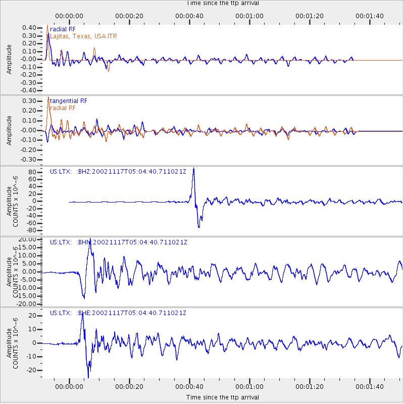
Signal To Noise
| Channel | StoN | STA | LTA |
| US:LTX: :BHN:20021117T05:04:40.711021Z | 34.308434 | 5.1136117E-6 | 1.4904825E-7 |
| US:LTX: :BHE:20021117T05:04:40.711021Z | 28.530724 | 7.653977E-6 | 2.682714E-7 |
| US:LTX: :BHZ:20021117T05:04:40.711021Z | 139.82782 | 3.040438E-5 | 2.1744157E-7 |
| Arrivals |
| Ps | |
| PpPs | |
| PsPs/PpSs | |


