You are here: Home > Network List > CN - Canadian National Seismograph Network Stations List
> Station INK INUVIK, NT > Earthquake Result Viewer
INK INUVIK, NT - Earthquake Result Viewer
*The percent match for this event was below the threshold and hence no stack was calculated.
| Earthquake location: |
Vanuatu Islands |
| Earthquake latitude/longitude: |
-16.0/167.4 |
| Earthquake time(UTC): |
2016/09/17 (261) 02:31:59 GMT |
| Earthquake Depth: |
37 km |
| Earthquake Magnitude: |
6.0 MWP |
| Earthquake Catalog/Contributor: |
NEIC PDE/NEIC COMCAT |
|
| Network: |
CN Canadian National Seismograph Network |
| Station: |
INK INUVIK, NT |
| Lat/Lon: |
68.31 N/133.53 W |
| Elevation: |
44 m |
|
| Distance: |
94.0 deg |
| Az: |
18.64 deg |
| Baz: |
235.768 deg |
| Ray Param: |
$rayparam |
*The percent match for this event was below the threshold and hence was not used in the summary stack. |
|
| Radial Match: |
67.20626 % |
| Radial Bump: |
400 |
| Transverse Match: |
53.28483 % |
| Transverse Bump: |
400 |
| SOD ConfigId: |
11737051 |
| Insert Time: |
2019-04-25 13:28:35.994 +0000 |
| GWidth: |
2.5 |
| Max Bumps: |
400 |
| Tol: |
0.001 |
|
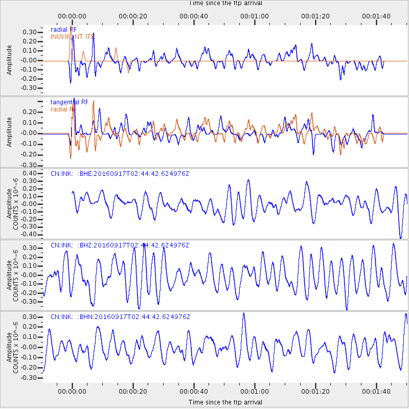
Signal To Noise
| Channel | StoN | STA | LTA |
| CN:INK: :BHZ:20160917T02:44:42.624976Z | 0.84397453 | 1.3431963E-7 | 1.5915128E-7 |
| CN:INK: :BHN:20160917T02:44:42.624976Z | 0.574461 | 5.937415E-8 | 1.0335628E-7 |
| CN:INK: :BHE:20160917T02:44:42.624976Z | 0.870379 | 7.7939944E-8 | 8.954713E-8 |
| Arrivals |
| Ps | |
| PpPs | |
| PsPs/PpSs | |


