You are here: Home > Network List > TA - USArray Transportable Network (new EarthScope stations) Stations List
> Station G21K Allakaket, AK, USA > Earthquake Result Viewer
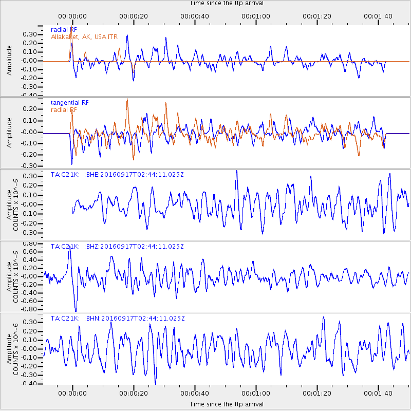
G21K Allakaket, AK, USA - Earthquake Result Viewer
*The percent match for this event was below the threshold and hence no stack was calculated.
| Earthquake location: |
Vanuatu Islands |
| Earthquake latitude/longitude: |
-16.0/167.4 |
| Earthquake time(UTC): |
2016/09/17 (261) 02:31:59 GMT |
| Earthquake Depth: |
37 km |
| Earthquake Magnitude: |
6.0 MWP |
| Earthquake Catalog/Contributor: |
NEIC PDE/NEIC COMCAT |
|
| Network: |
TA USArray Transportable Network (new EarthScope stations) |
| Station: |
G21K Allakaket, AK, USA |
| Lat/Lon: |
66.52 N/153.51 W |
| Elevation: |
446 m |
|
| Distance: |
87.2 deg |
| Az: |
14.646 deg |
| Baz: |
217.354 deg |
| Ray Param: |
$rayparam |
*The percent match for this event was below the threshold and hence was not used in the summary stack. |
|
| Radial Match: |
59.17934 % |
| Radial Bump: |
400 |
| Transverse Match: |
62.79036 % |
| Transverse Bump: |
400 |
| SOD ConfigId: |
11737051 |
| Insert Time: |
2019-04-25 13:30:47.779 +0000 |
| GWidth: |
2.5 |
| Max Bumps: |
400 |
| Tol: |
0.001 |
|
Signal To Noise
| Channel | StoN | STA | LTA |
| TA:G21K: :BHZ:20160917T02:44:11.025Z | 6.3271475 | 4.0150653E-7 | 6.345775E-8 |
| TA:G21K: :BHN:20160917T02:44:11.025Z | 1.0658108 | 1.1977245E-7 | 1.1237683E-7 |
| TA:G21K: :BHE:20160917T02:44:11.025Z | 0.83043206 | 7.770013E-8 | 9.356591E-8 |
| Arrivals |
| Ps | |
| PpPs | |
| PsPs/PpSs | |


