You are here: Home > Network List > G - GEOSCOPE Stations List
> Station TAOE Taiohae, Marquises islands > Earthquake Result Viewer
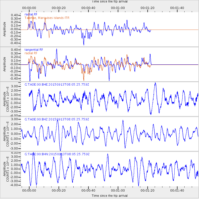
TAOE Taiohae, Marquises islands - Earthquake Result Viewer
*The percent match for this event was below the threshold and hence no stack was calculated.
| Earthquake location: |
Gulf Of California |
| Earthquake latitude/longitude: |
25.1/-109.2 |
| Earthquake time(UTC): |
2015/09/13 (256) 07:57:38 GMT |
| Earthquake Depth: |
10 km |
| Earthquake Magnitude: |
5.6 MWW, 5.5 MWB, 5.6 MWC |
| Earthquake Catalog/Contributor: |
NEIC PDE/NEIC COMCAT |
|
| Network: |
G GEOSCOPE |
| Station: |
TAOE Taiohae, Marquises islands |
| Lat/Lon: |
8.85 S/140.15 W |
| Elevation: |
800 m |
|
| Distance: |
45.3 deg |
| Az: |
225.667 deg |
| Baz: |
41.0 deg |
| Ray Param: |
$rayparam |
*The percent match for this event was below the threshold and hence was not used in the summary stack. |
|
| Radial Match: |
49.25987 % |
| Radial Bump: |
400 |
| Transverse Match: |
66.54506 % |
| Transverse Bump: |
312 |
| SOD ConfigId: |
1156111 |
| Insert Time: |
2015-10-08 08:24:25.807 +0000 |
| GWidth: |
2.5 |
| Max Bumps: |
400 |
| Tol: |
0.001 |
|
Signal To Noise
| Channel | StoN | STA | LTA |
| G:TAOE:00:BHZ:20150913T08:05:25.759Z | 0.58315086 | 6.8239046E-7 | 1.1701782E-6 |
| G:TAOE:00:BHN:20150913T08:05:25.759Z | 2.5849993 | 2.5653121E-6 | 9.92384E-7 |
| G:TAOE:00:BHE:20150913T08:05:25.759Z | 0.52557296 | 6.2701343E-7 | 1.1930093E-6 |
| Arrivals |
| Ps | |
| PpPs | |
| PsPs/PpSs | |


