You are here: Home > Network List > IU - Global Seismograph Network (GSN - IRIS/USGS) Stations List
> Station JOHN Johnston Island, USA > Earthquake Result Viewer
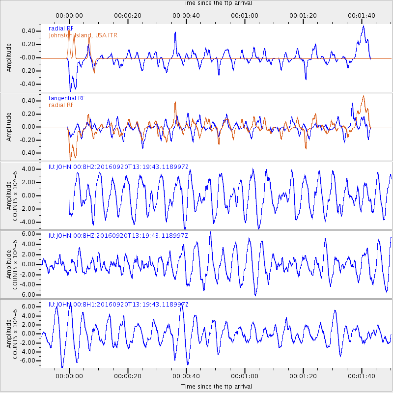
JOHN Johnston Island, USA - Earthquake Result Viewer
*The percent match for this event was below the threshold and hence no stack was calculated.
| Earthquake location: |
Near North Coast Of Irian Jaya |
| Earthquake latitude/longitude: |
-2.0/138.7 |
| Earthquake time(UTC): |
2016/09/20 (264) 13:10:47 GMT |
| Earthquake Depth: |
10 km |
| Earthquake Magnitude: |
5.4 Mwb |
| Earthquake Catalog/Contributor: |
NEIC PDE/us |
|
| Network: |
IU Global Seismograph Network (GSN - IRIS/USGS) |
| Station: |
JOHN Johnston Island, USA |
| Lat/Lon: |
16.73 N/169.53 W |
| Elevation: |
2.0 m |
|
| Distance: |
54.3 deg |
| Az: |
67.838 deg |
| Baz: |
255.008 deg |
| Ray Param: |
$rayparam |
*The percent match for this event was below the threshold and hence was not used in the summary stack. |
|
| Radial Match: |
49.996353 % |
| Radial Bump: |
400 |
| Transverse Match: |
46.361458 % |
| Transverse Bump: |
393 |
| SOD ConfigId: |
11737051 |
| Insert Time: |
2019-04-25 13:40:28.358 +0000 |
| GWidth: |
2.5 |
| Max Bumps: |
400 |
| Tol: |
0.001 |
|
Signal To Noise
| Channel | StoN | STA | LTA |
| IU:JOHN:00:BHZ:20160920T13:19:43.118997Z | 1.4891446 | 1.5351494E-6 | 1.0308934E-6 |
| IU:JOHN:00:BH1:20160920T13:19:43.118997Z | 2.924414 | 4.368384E-6 | 1.4937641E-6 |
| IU:JOHN:00:BH2:20160920T13:19:43.118997Z | 0.9570279 | 2.1533433E-6 | 2.250032E-6 |
| Arrivals |
| Ps | |
| PpPs | |
| PsPs/PpSs | |


