You are here: Home > Network List > TA - USArray Transportable Network (new EarthScope stations) Stations List
> Station MDND Maddock, ND, USA > Earthquake Result Viewer
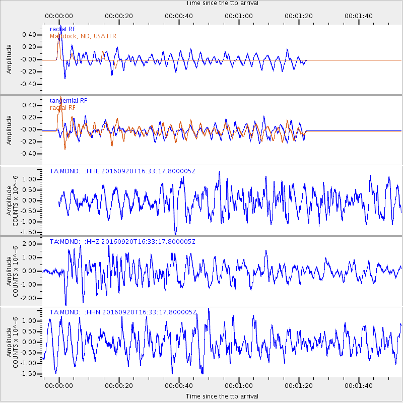
MDND Maddock, ND, USA - Earthquake Result Viewer
*The percent match for this event was below the threshold and hence no stack was calculated.
| Earthquake location: |
Southeast Of Honshu, Japan |
| Earthquake latitude/longitude: |
30.5/142.1 |
| Earthquake time(UTC): |
2016/09/20 (264) 16:21:16 GMT |
| Earthquake Depth: |
10 km |
| Earthquake Magnitude: |
6.1 MWW, 6.0 MWB |
| Earthquake Catalog/Contributor: |
NEIC PDE/NEIC COMCAT |
|
| Network: |
TA USArray Transportable Network (new EarthScope stations) |
| Station: |
MDND Maddock, ND, USA |
| Lat/Lon: |
47.85 N/99.60 W |
| Elevation: |
479 m |
|
| Distance: |
84.4 deg |
| Az: |
36.572 deg |
| Baz: |
310.252 deg |
| Ray Param: |
$rayparam |
*The percent match for this event was below the threshold and hence was not used in the summary stack. |
|
| Radial Match: |
70.70992 % |
| Radial Bump: |
400 |
| Transverse Match: |
52.463078 % |
| Transverse Bump: |
285 |
| SOD ConfigId: |
11737051 |
| Insert Time: |
2019-04-25 13:52:40.599 +0000 |
| GWidth: |
2.5 |
| Max Bumps: |
400 |
| Tol: |
0.001 |
|
Signal To Noise
| Channel | StoN | STA | LTA |
| TA:MDND: :HHZ:20160920T16:33:17.800005Z | 6.6396327 | 9.457595E-7 | 1.4244154E-7 |
| TA:MDND: :HHN:20160920T16:33:17.800005Z | 1.7264086 | 7.04956E-7 | 4.083367E-7 |
| TA:MDND: :HHE:20160920T16:33:17.800005Z | 1.0567566 | 3.9116512E-7 | 3.701563E-7 |
| Arrivals |
| Ps | |
| PpPs | |
| PsPs/PpSs | |


