WVT Waverly, Tennessee, USA - Earthquake Result Viewer
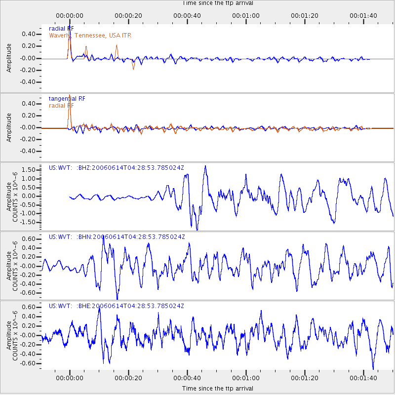
Earthquake location: Rat Islands, Aleutian Islands
Earthquake latitude/longitude: 51.8/177.1
Earthquake time(UTC): 2006/06/14 (165) 04:18:42 GMT
Earthquake Depth: 14 km
Earthquake Magnitude: 5.9 MB, 6.4 MS, 6.4 MW, 6.4 MW
Earthquake Catalog/Contributor: WHDF/NEIC
Network: US United States National Seismic Network
Station: WVT Waverly, Tennessee, USA
Lat/Lon: 36.13 N/87.83 W
Elevation: 153 m
Distance: 65.5 deg
Az: 62.422 deg
Baz: 317.108 deg
Ray Param: 0.058243625
Estimated Moho Depth: 33.75 km
Estimated Crust Vp/Vs: 1.82
Assumed Crust Vp: 6.444 km/s
Estimated Crust Vs: 3.536 km/s
Estimated Crust Poisson's Ratio: 0.28
Radial Match: 92.04478 %
Radial Bump: 368
Transverse Match: 62.80803 %
Transverse Bump: 400
SOD ConfigId: 5745
Insert Time: 2010-03-05 07:07:43.533 +0000
GWidth: 2.5
Max Bumps: 400
Tol: 0.001

Signal To Noise

ChannelStoNSTALTA
US:WVT: :BHN:20060614T04:28:53.785024Z0.70839865.7612542E-88.132786E-8
US:WVT: :BHE:20060614T04:28:53.785024Z1.97317211.6928266E-78.579214E-8
US:WVT: :BHZ:20060614T04:28:53.785024Z4.0758263.3173083E-78.1389835E-8
Arrivals
Ps4.5 SECOND
PpPs14 SECOND
PsPs/PpSs19 SECOND