You are here: Home > Network List > TA - USArray Transportable Network (new EarthScope stations) Stations List
> Station TUL1 Leonard, OK, USA > Earthquake Result Viewer
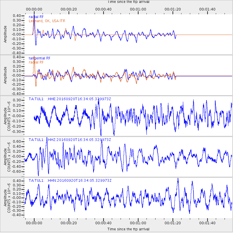
TUL1 Leonard, OK, USA - Earthquake Result Viewer
*The percent match for this event was below the threshold and hence no stack was calculated.
| Earthquake location: |
Southeast Of Honshu, Japan |
| Earthquake latitude/longitude: |
30.5/142.1 |
| Earthquake time(UTC): |
2016/09/20 (264) 16:21:16 GMT |
| Earthquake Depth: |
10 km |
| Earthquake Magnitude: |
6.1 MWW, 6.0 MWB |
| Earthquake Catalog/Contributor: |
NEIC PDE/NEIC COMCAT |
|
| Network: |
TA USArray Transportable Network (new EarthScope stations) |
| Station: |
TUL1 Leonard, OK, USA |
| Lat/Lon: |
35.91 N/95.79 W |
| Elevation: |
256 m |
|
| Distance: |
94.4 deg |
| Az: |
43.594 deg |
| Baz: |
312.875 deg |
| Ray Param: |
$rayparam |
*The percent match for this event was below the threshold and hence was not used in the summary stack. |
|
| Radial Match: |
73.165504 % |
| Radial Bump: |
376 |
| Transverse Match: |
51.36504 % |
| Transverse Bump: |
344 |
| SOD ConfigId: |
11737051 |
| Insert Time: |
2019-04-25 13:53:17.331 +0000 |
| GWidth: |
2.5 |
| Max Bumps: |
400 |
| Tol: |
0.001 |
|
Signal To Noise
| Channel | StoN | STA | LTA |
| TA:TUL1: :HHZ:20160920T16:34:05.329973Z | 2.6754076 | 2.6731686E-7 | 9.991631E-8 |
| TA:TUL1: :HHN:20160920T16:34:05.329973Z | 1.6715637 | 1.4183234E-7 | 8.485009E-8 |
| TA:TUL1: :HHE:20160920T16:34:05.329973Z | 0.9880577 | 9.880609E-8 | 1.0000033E-7 |
| Arrivals |
| Ps | |
| PpPs | |
| PsPs/PpSs | |


