You are here: Home > Network List > US - United States National Seismic Network Stations List
> Station WVT Waverly, Tennessee, USA > Earthquake Result Viewer
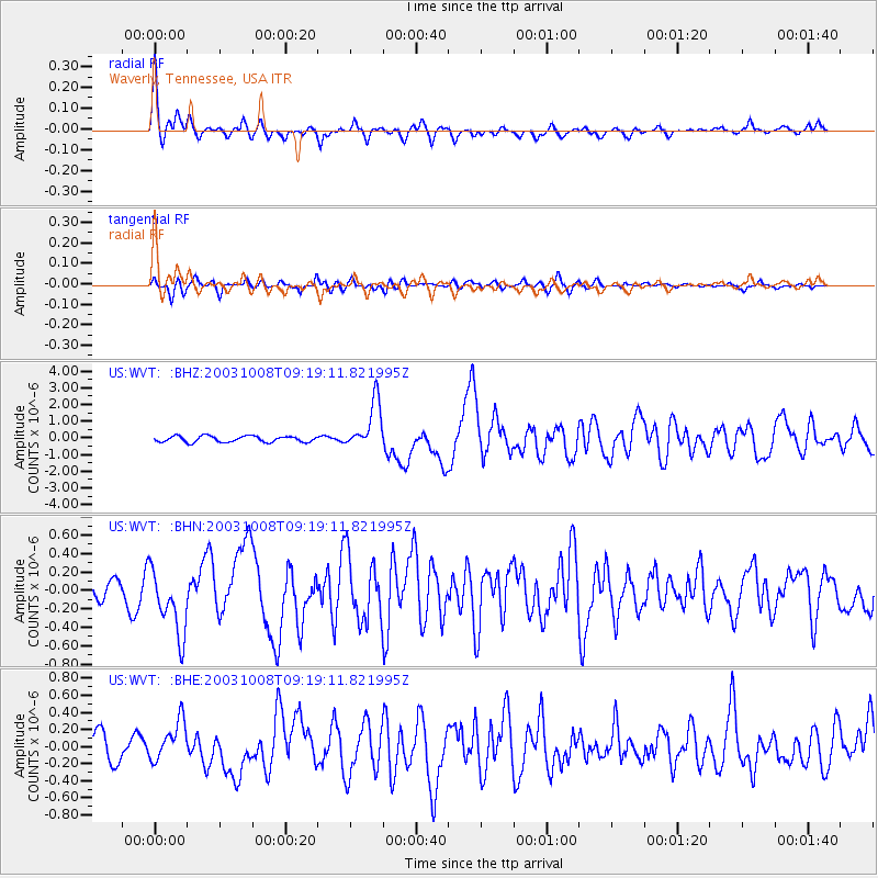
WVT Waverly, Tennessee, USA - Earthquake Result Viewer

| Earthquake location: |
Hokkaido, Japan Region |
| Earthquake latitude/longitude: |
42.6/144.6 |
| Earthquake time(UTC): |
2003/10/08 (281) 09:06:55 GMT |
| Earthquake Depth: |
32 km |
| Earthquake Magnitude: |
6.0 MB, 6.6 MS, 6.7 MW, 6.6 MW |
| Earthquake Catalog/Contributor: |
WHDF/NEIC |
|
| Network: |
US United States National Seismic Network |
| Station: |
WVT Waverly, Tennessee, USA |
| Lat/Lon: |
36.13 N/87.83 W |
| Elevation: |
153 m |
|
| Distance: |
88.2 deg |
| Az: |
39.921 deg |
| Baz: |
324.208 deg |
| Ray Param: |
0.042740908 |
| Estimated Moho Depth: |
41.25 km |
| Estimated Crust Vp/Vs: |
1.60 |
| Assumed Crust Vp: |
6.444 km/s |
| Estimated Crust Vs: |
4.027 km/s |
| Estimated Crust Poisson's Ratio: |
0.18 |
|
| Radial Match: |
80.79726 % |
| Radial Bump: |
340 |
| Transverse Match: |
67.01386 % |
| Transverse Bump: |
400 |
| SOD ConfigId: |
110177 |
| Insert Time: |
2010-03-05 07:08:12.405 +0000 |
| GWidth: |
2.5 |
| Max Bumps: |
400 |
| Tol: |
0.001 |
|
Signal To Noise
| Channel | StoN | STA | LTA |
| US:WVT: :BHN:20031008T09:19:11.821995Z | 3.2641444 | 3.5107624E-7 | 1.07555366E-7 |
| US:WVT: :BHE:20031008T09:19:11.821995Z | 1.6103978 | 2.2615492E-7 | 1.404342E-7 |
| US:WVT: :BHZ:20031008T09:19:11.821995Z | 8.046183 | 1.4213994E-6 | 1.7665512E-7 |
| Arrivals |
| Ps | 3.9 SECOND |
| PpPs | 16 SECOND |
| PsPs/PpSs | 20 SECOND |


