You are here: Home > Network List > US - United States National Seismic Network Stations List
> Station LSCT Lakeside, Connecticut, USA > Earthquake Result Viewer
LSCT Lakeside, Connecticut, USA - Earthquake Result Viewer
| Earthquake location: |
Near Coast Of Nicaragua |
| Earthquake latitude/longitude: |
12.2/-87.4 |
| Earthquake time(UTC): |
2004/04/28 (119) 04:08:59 GMT |
| Earthquake Depth: |
62 km |
| Earthquake Magnitude: |
5.2 MB, 5.6 MW, 5.5 MW |
| Earthquake Catalog/Contributor: |
WHDF/NEIC |
|
| Network: |
US United States National Seismic Network |
| Station: |
LSCT Lakeside, Connecticut, USA |
| Lat/Lon: |
41.68 N/73.22 W |
| Elevation: |
318 m |
|
| Distance: |
31.9 deg |
| Az: |
20.336 deg |
| Baz: |
206.979 deg |
| Ray Param: |
0.078728914 |
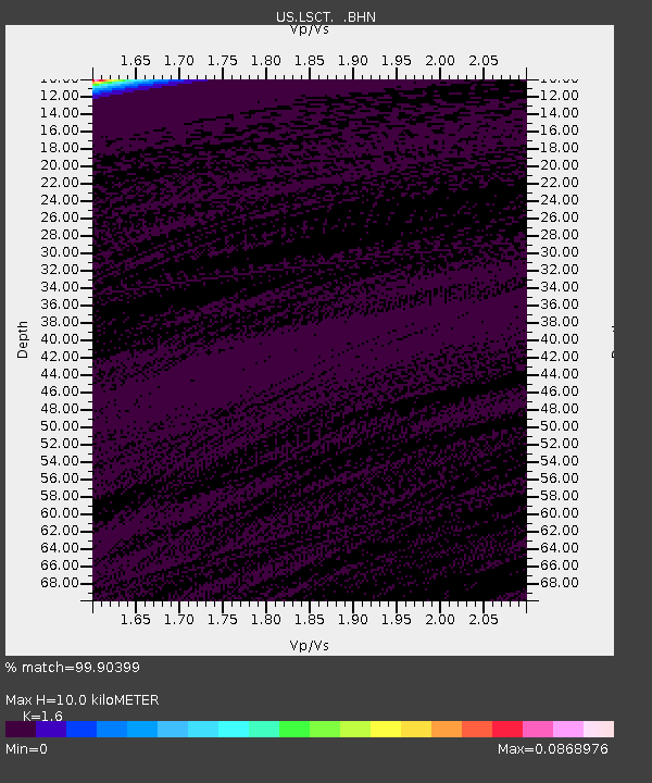
| Estimated Moho Depth: |
10.0 km |
| Estimated Crust Vp/Vs: |
1.60 |
| Assumed Crust Vp: |
6.472 km/s |
| Estimated Crust Vs: |
4.045 km/s |
| Estimated Crust Poisson's Ratio: |
0.18 |
|
| Radial Match: |
99.90399 % |
| Radial Bump: |
17 |
| Transverse Match: |
99.903404 % |
| Transverse Bump: |
17 |
| SOD ConfigId: |
110165 |
| Insert Time: |
2010-03-05 07:08:51.930 +0000 |
| GWidth: |
2.5 |
| Max Bumps: |
400 |
| Tol: |
0.001 |
|
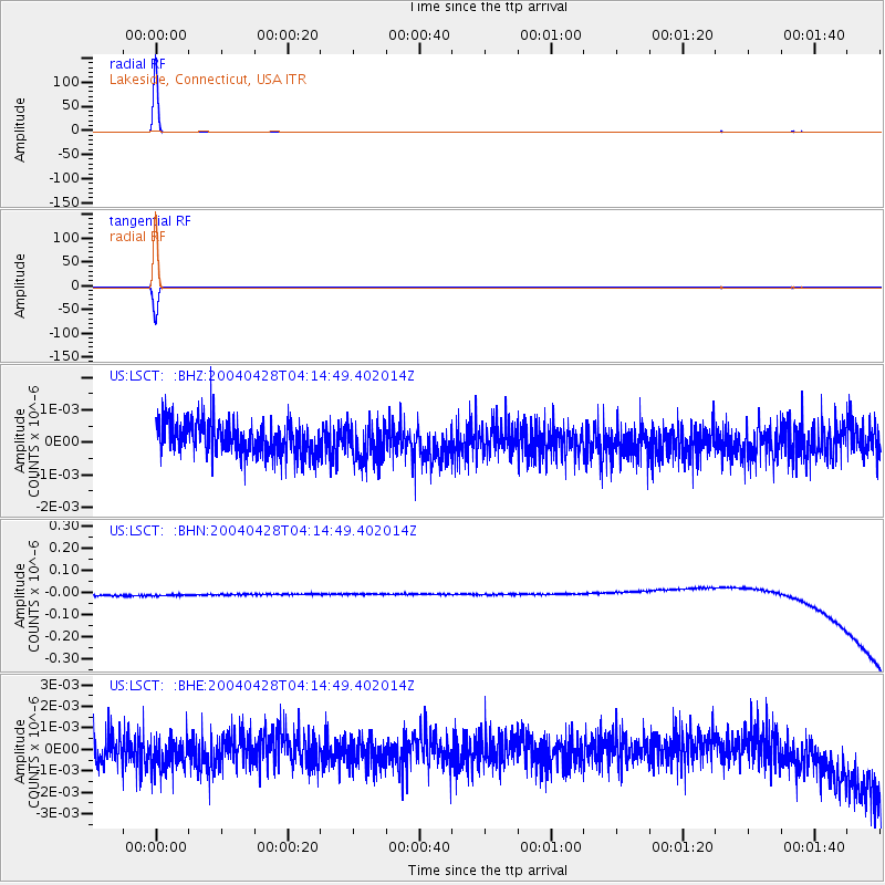
Signal To Noise
| Channel | StoN | STA | LTA |
| US:LSCT: :BHN:20040428T04:14:49.402014Z | 0.9147101 | 2.5580878E-8 | 2.7966102E-8 |
| US:LSCT: :BHE:20040428T04:14:49.402014Z | 1.1193992 | 7.633586E-10 | 6.81936E-10 |
| US:LSCT: :BHZ:20040428T04:14:49.402014Z | 1.0398513 | 5.481025E-10 | 5.2709703E-10 |
| Arrivals |
| Ps | 1.0 SECOND |
| PpPs | 3.7 SECOND |
| PsPs/PpSs | 4.7 SECOND |


