You are here: Home > Network List > US - United States National Seismic Network Stations List
> Station LSCT Lakeside, Connecticut, USA > Earthquake Result Viewer
LSCT Lakeside, Connecticut, USA - Earthquake Result Viewer
| Earthquake location: |
Near Coast Of Central Chile |
| Earthquake latitude/longitude: |
-30.0/-72.0 |
| Earthquake time(UTC): |
2004/04/03 (094) 09:57:13 GMT |
| Earthquake Depth: |
34 km |
| Earthquake Magnitude: |
5.5 MB, 5.1 MS, 5.5 MW, 5.4 MW |
| Earthquake Catalog/Contributor: |
WHDF/NEIC |
|
| Network: |
US United States National Seismic Network |
| Station: |
LSCT Lakeside, Connecticut, USA |
| Lat/Lon: |
41.68 N/73.22 W |
| Elevation: |
318 m |
|
| Distance: |
71.3 deg |
| Az: |
359.02 deg |
| Baz: |
178.865 deg |
| Ray Param: |
0.054355755 |
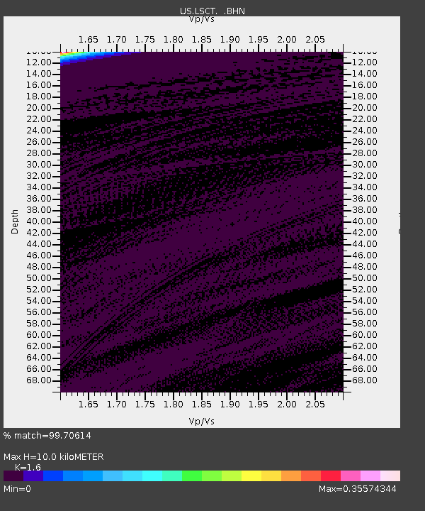
| Estimated Moho Depth: |
10.0 km |
| Estimated Crust Vp/Vs: |
1.60 |
| Assumed Crust Vp: |
6.472 km/s |
| Estimated Crust Vs: |
4.045 km/s |
| Estimated Crust Poisson's Ratio: |
0.18 |
|
| Radial Match: |
99.70614 % |
| Radial Bump: |
22 |
| Transverse Match: |
99.708954 % |
| Transverse Bump: |
23 |
| SOD ConfigId: |
110165 |
| Insert Time: |
2010-03-05 07:08:56.846 +0000 |
| GWidth: |
2.5 |
| Max Bumps: |
400 |
| Tol: |
0.001 |
|
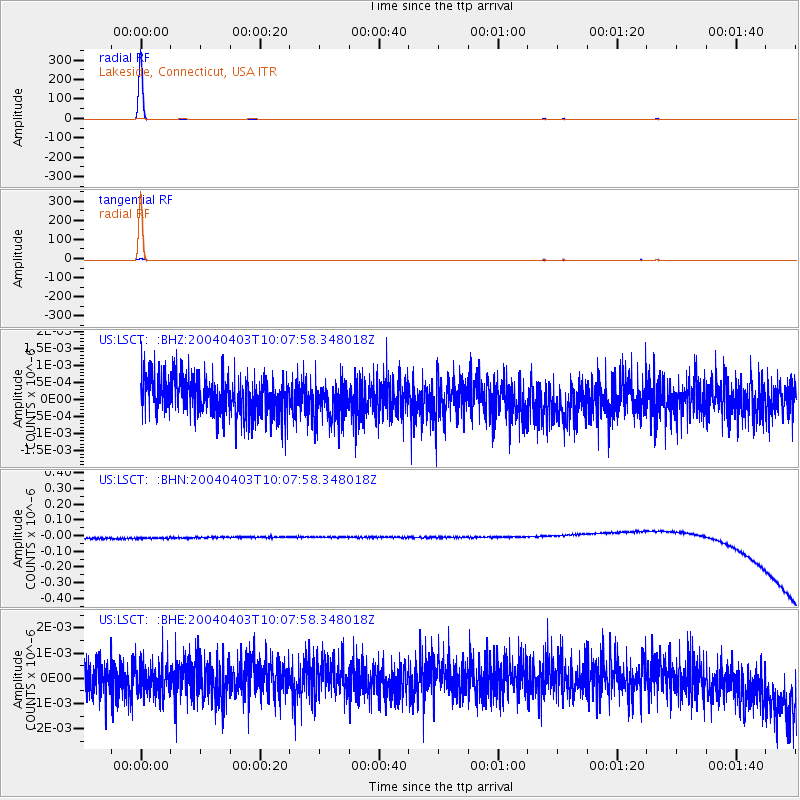
Signal To Noise
| Channel | StoN | STA | LTA |
| US:LSCT: :BHN:20040403T10:07:58.348018Z | 0.9149481 | 3.2427625E-8 | 3.5442035E-8 |
| US:LSCT: :BHE:20040403T10:07:58.348018Z | 0.92319494 | 6.529718E-10 | 7.0729567E-10 |
| US:LSCT: :BHZ:20040403T10:07:58.348018Z | 0.99294394 | 5.4512034E-10 | 5.489941E-10 |
| Arrivals |
| Ps | 1.0 SECOND |
| PpPs | 3.9 SECOND |
| PsPs/PpSs | 4.8 SECOND |


