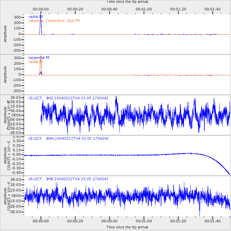
LSCT Lakeside, Connecticut, USA - Earthquake Result Viewer
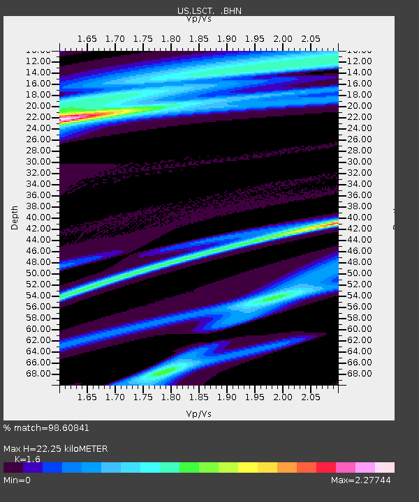
Earthquake location: Salta Province, Argentina
Earthquake latitude/longitude: -22.9/-64.4
Earthquake time(UTC): 2004/03/22 (082) 04:22:58 GMT
Earthquake Depth: 16 km
Earthquake Magnitude: 5.7 MB, 5.4 MS, 5.8 MW, 5.7 MW
Earthquake Catalog/Contributor: WHDF/NEIC
Network: US United States National Seismic Network
Station: LSCT Lakeside, Connecticut, USA
Lat/Lon: 41.68 N/73.22 W
Elevation: 318 m
Distance: 64.8 deg
Az: 352.67 deg
Baz: 170.967 deg
Ray Param: 0.058670614
Estimated Moho Depth: 22.25 km
Estimated Crust Vp/Vs: 1.60
Assumed Crust Vp: 6.472 km/s
Estimated Crust Vs: 4.045 km/s
Estimated Crust Poisson's Ratio: 0.18
Radial Match: 98.60841 %
Radial Bump: 62
Transverse Match: 98.62331 %
Transverse Bump: 61
SOD ConfigId: 110165
Insert Time: 2010-03-05 07:08:58.350 +0000
GWidth: 2.5
Max Bumps: 400
Tol: 0.001

Signal To Noise

ChannelStoNSTALTA
US:LSCT: :BHN:20040322T04:33:05.179004Z0.906938253.2195256E-83.549884E-8
US:LSCT: :BHE:20040322T04:33:05.179004Z0.871900866.7158346E-107.702521E-10
US:LSCT: :BHZ:20040322T04:33:05.179004Z0.96672526.1330446E-106.3441447E-10
Arrivals
Ps2.2 SECOND
PpPs8.5 SECOND
PsPs/PpSs11 SECOND