
LSCT Lakeside, Connecticut, USA - Earthquake Result Viewer
| ||||||||||||||||||
| ||||||||||||||||||
| ||||||||||||||||||
|
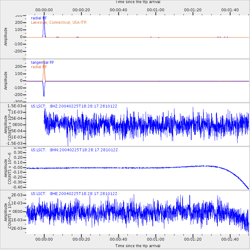
Signal To Noise
| Channel | StoN | STA | LTA |
| US:LSCT: :BHN:20040225T18:28:17.281012Z | 0.9029234 | 3.210289E-8 | 3.5554386E-8 |
| US:LSCT: :BHE:20040225T18:28:17.281012Z | 0.83946294 | 5.464008E-10 | 6.5089334E-10 |
| US:LSCT: :BHZ:20040225T18:28:17.281012Z | 0.8945834 | 3.8463507E-10 | 4.2996E-10 |
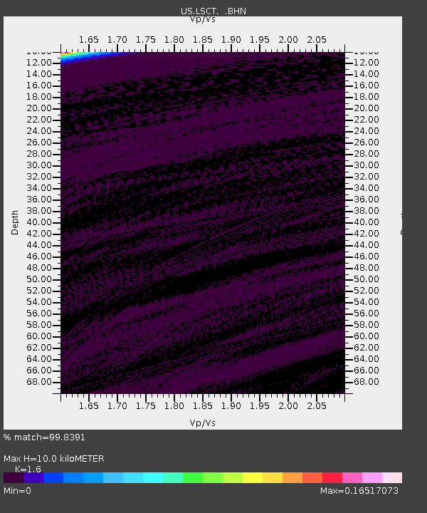
| Arrivals | |
| Ps | 1.0 SECOND |
| PpPs | 3.7 SECOND |
| PsPs/PpSs | 4.7 SECOND |

