
LSCT Lakeside, Connecticut, USA - Earthquake Result Viewer
| ||||||||||||||||||
| ||||||||||||||||||
| ||||||||||||||||||
|
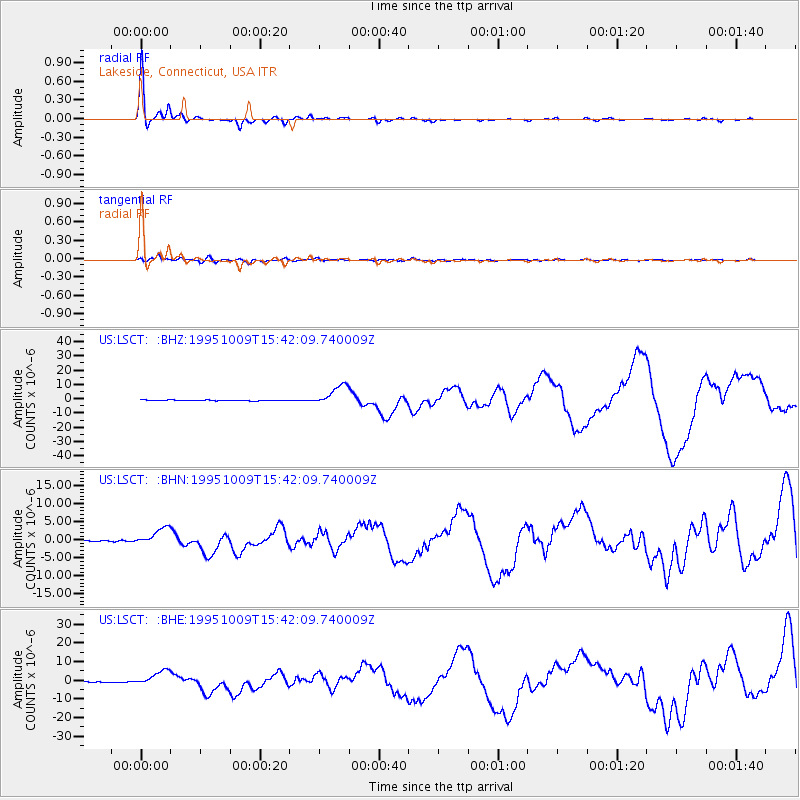
Signal To Noise
| Channel | StoN | STA | LTA |
| US:LSCT: :BHN:19951009T15:42:09.740009Z | 14.946349 | 2.4452868E-6 | 1.6360428E-7 |
| US:LSCT: :BHE:19951009T15:42:09.740009Z | 19.815586 | 4.137041E-6 | 2.0877711E-7 |
| US:LSCT: :BHZ:19951009T15:42:09.740009Z | 25.063488 | 7.164577E-6 | 2.8585714E-7 |
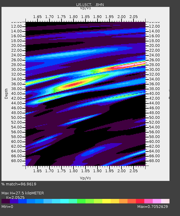
| Arrivals | |
| Ps | 4.8 SECOND |
| PpPs | 12 SECOND |
| PsPs/PpSs | 17 SECOND |

