You are here: Home > Network List > US - United States National Seismic Network Stations List
> Station LSCT Lakeside, Connecticut, USA > Earthquake Result Viewer
LSCT Lakeside, Connecticut, USA - Earthquake Result Viewer
| Earthquake location: |
Central Peru |
| Earthquake latitude/longitude: |
-10.9/-76.1 |
| Earthquake time(UTC): |
2005/02/17 (048) 03:12:46 GMT |
| Earthquake Depth: |
126 km |
| Earthquake Magnitude: |
5.3 MB, 5.5 MW, 5.4 MW |
| Earthquake Catalog/Contributor: |
WHDF/NEIC |
|
| Network: |
US United States National Seismic Network |
| Station: |
LSCT Lakeside, Connecticut, USA |
| Lat/Lon: |
41.68 N/73.22 W |
| Elevation: |
318 m |
|
| Distance: |
52.4 deg |
| Az: |
2.719 deg |
| Baz: |
183.566 deg |
| Ray Param: |
0.06636225 |
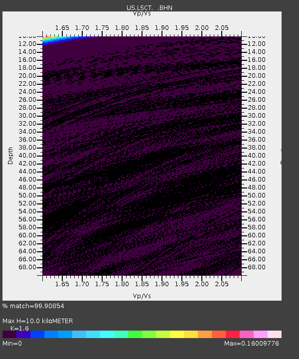
| Estimated Moho Depth: |
10.0 km |
| Estimated Crust Vp/Vs: |
1.60 |
| Assumed Crust Vp: |
6.472 km/s |
| Estimated Crust Vs: |
4.045 km/s |
| Estimated Crust Poisson's Ratio: |
0.18 |
|
| Radial Match: |
99.90854 % |
| Radial Bump: |
22 |
| Transverse Match: |
99.91024 % |
| Transverse Bump: |
24 |
| SOD ConfigId: |
110165 |
| Insert Time: |
2010-03-05 07:09:18.554 +0000 |
| GWidth: |
2.5 |
| Max Bumps: |
400 |
| Tol: |
0.001 |
|
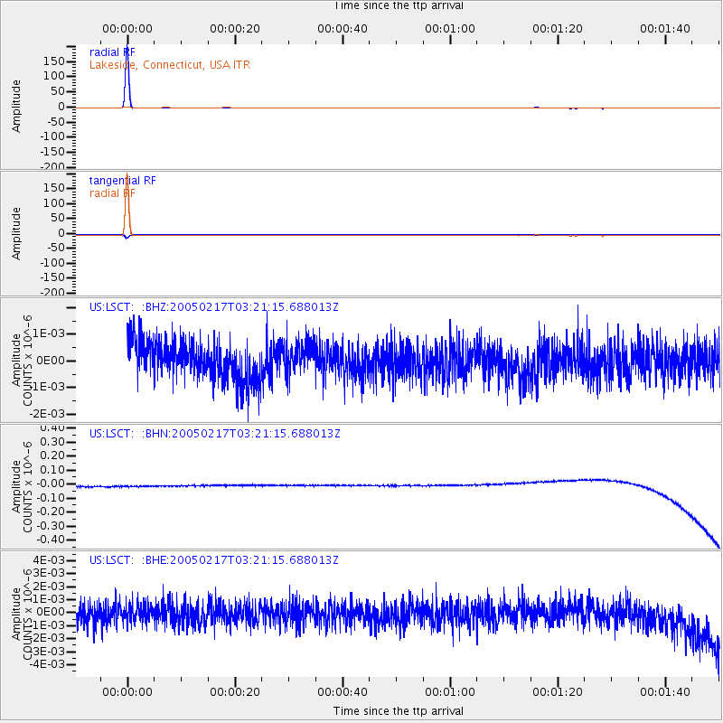
Signal To Noise
| Channel | StoN | STA | LTA |
| US:LSCT: :BHN:20050217T03:21:15.688013Z | 0.908344 | 3.3132466E-8 | 3.6475683E-8 |
| US:LSCT: :BHE:20050217T03:21:15.688013Z | 0.7853942 | 6.4214767E-10 | 8.17612E-10 |
| US:LSCT: :BHZ:20050217T03:21:15.688013Z | 0.81167734 | 5.6748384E-10 | 6.9914957E-10 |
| Arrivals |
| Ps | 1.0 SECOND |
| PpPs | 3.8 SECOND |
| PsPs/PpSs | 4.8 SECOND |


