You are here: Home > Network List > US - United States National Seismic Network Stations List
> Station LSCT Lakeside, Connecticut, USA > Earthquake Result Viewer
LSCT Lakeside, Connecticut, USA - Earthquake Result Viewer
| Earthquake location: |
Off Coast Of Ecuador |
| Earthquake latitude/longitude: |
-1.1/-81.2 |
| Earthquake time(UTC): |
2005/01/28 (028) 15:46:45 GMT |
| Earthquake Depth: |
10 km |
| Earthquake Magnitude: |
5.4 MB, 5.5 MS, 6.2 MW, 5.9 MW |
| Earthquake Catalog/Contributor: |
WHDF/NEIC |
|
| Network: |
US United States National Seismic Network |
| Station: |
LSCT Lakeside, Connecticut, USA |
| Lat/Lon: |
41.68 N/73.22 W |
| Elevation: |
318 m |
|
| Distance: |
43.2 deg |
| Az: |
8.691 deg |
| Baz: |
191.635 deg |
| Ray Param: |
0.07272306 |
| Estimated Moho Depth: |
10.0 km |
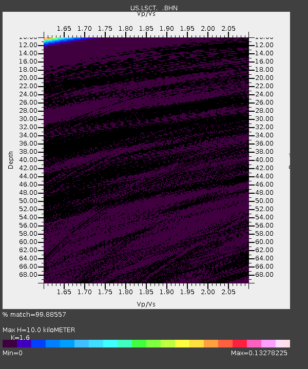
| Estimated Crust Vp/Vs: |
1.60 |
| Assumed Crust Vp: |
6.472 km/s |
| Estimated Crust Vs: |
4.045 km/s |
| Estimated Crust Poisson's Ratio: |
0.18 |
|
| Radial Match: |
99.88557 % |
| Radial Bump: |
12 |
| Transverse Match: |
99.885826 % |
| Transverse Bump: |
12 |
| SOD ConfigId: |
110165 |
| Insert Time: |
2010-03-05 07:09:21.727 +0000 |
| GWidth: |
2.5 |
| Max Bumps: |
400 |
| Tol: |
0.001 |
|
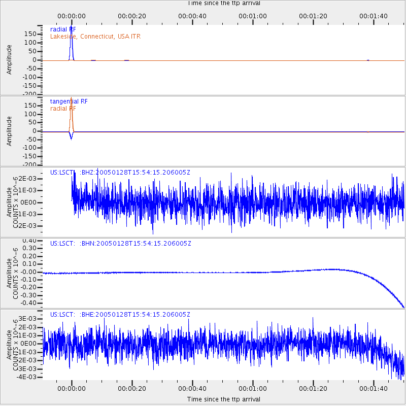
Signal To Noise
| Channel | StoN | STA | LTA |
| US:LSCT: :BHN:20050128T15:54:15.206005Z | 0.9063557 | 3.3137383E-8 | 3.6561126E-8 |
| US:LSCT: :BHE:20050128T15:54:15.206005Z | 1.0950003 | 9.950417E-10 | 9.0871366E-10 |
| US:LSCT: :BHZ:20050128T15:54:15.206005Z | 0.9079731 | 7.011138E-10 | 7.7217455E-10 |
| Arrivals |
| Ps | 1.0 SECOND |
| PpPs | 3.7 SECOND |
| PsPs/PpSs | 4.7 SECOND |


