You are here: Home > Network List > US - United States National Seismic Network Stations List
> Station LSCT Lakeside, Connecticut, USA > Earthquake Result Viewer
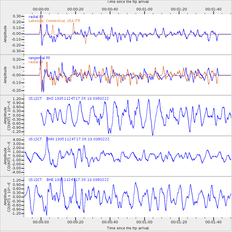
LSCT Lakeside, Connecticut, USA - Earthquake Result Viewer
*The percent match for this event was below the threshold and hence no stack was calculated.
| Earthquake location: |
Kuril Islands |
| Earthquake latitude/longitude: |
44.5/149.1 |
| Earthquake time(UTC): |
1995/11/24 (328) 17:24:12 GMT |
| Earthquake Depth: |
33 km |
| Earthquake Magnitude: |
6.1 MB, 6.3 MS, 6.1 UNKNOWN, 6.6 MW |
| Earthquake Catalog/Contributor: |
WHDF/NEIC |
|
| Network: |
US United States National Seismic Network |
| Station: |
LSCT Lakeside, Connecticut, USA |
| Lat/Lon: |
41.68 N/73.22 W |
| Elevation: |
318 m |
|
| Distance: |
86.2 deg |
| Az: |
30.36 deg |
| Baz: |
331.152 deg |
| Ray Param: |
$rayparam |
*The percent match for this event was below the threshold and hence was not used in the summary stack. |
|
| Radial Match: |
68.14166 % |
| Radial Bump: |
400 |
| Transverse Match: |
70.2901 % |
| Transverse Bump: |
400 |
| SOD ConfigId: |
4480 |
| Insert Time: |
2010-03-05 07:09:31.726 +0000 |
| GWidth: |
2.5 |
| Max Bumps: |
400 |
| Tol: |
0.001 |
|
Signal To Noise
| Channel | StoN | STA | LTA |
| US:LSCT: :BHN:19951124T17:36:19.098022Z | 2.8562431 | 1.826668E-6 | 6.3953524E-7 |
| US:LSCT: :BHE:19951124T17:36:19.098022Z | 1.1519886 | 6.2339404E-7 | 5.4114605E-7 |
| US:LSCT: :BHZ:19951124T17:36:19.098022Z | 0.8889636 | 4.141085E-7 | 4.6583293E-7 |
| Arrivals |
| Ps | |
| PpPs | |
| PsPs/PpSs | |


