You are here: Home > Network List > US - United States National Seismic Network Stations List
> Station LSCT Lakeside, Connecticut, USA > Earthquake Result Viewer
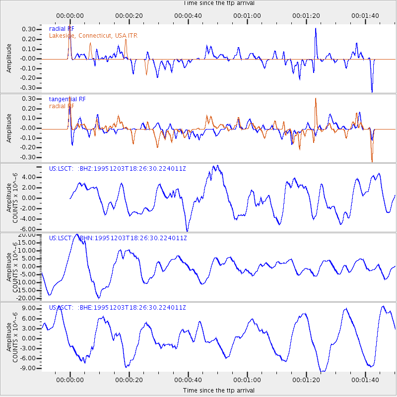
LSCT Lakeside, Connecticut, USA - Earthquake Result Viewer
*The percent match for this event was below the threshold and hence no stack was calculated.
| Earthquake location: |
East Of Kuril Islands |
| Earthquake latitude/longitude: |
44.8/150.7 |
| Earthquake time(UTC): |
1995/12/03 (337) 18:14:27 GMT |
| Earthquake Depth: |
33 km |
| Earthquake Magnitude: |
6.4 MB, 6.6 MS |
| Earthquake Catalog/Contributor: |
WHDF/NEIC |
|
| Network: |
US United States National Seismic Network |
| Station: |
LSCT Lakeside, Connecticut, USA |
| Lat/Lon: |
41.68 N/73.22 W |
| Elevation: |
318 m |
|
| Distance: |
85.3 deg |
| Az: |
31.418 deg |
| Baz: |
330.328 deg |
| Ray Param: |
$rayparam |
*The percent match for this event was below the threshold and hence was not used in the summary stack. |
|
| Radial Match: |
78.039955 % |
| Radial Bump: |
400 |
| Transverse Match: |
59.95359 % |
| Transverse Bump: |
400 |
| SOD ConfigId: |
4480 |
| Insert Time: |
2010-03-05 07:09:32.767 +0000 |
| GWidth: |
2.5 |
| Max Bumps: |
400 |
| Tol: |
0.001 |
|
Signal To Noise
| Channel | StoN | STA | LTA |
| US:LSCT: :BHN:19951203T18:26:30.224011Z | 1.823681 | 1.6344218E-5 | 8.9622135E-6 |
| US:LSCT: :BHE:19951203T18:26:30.224011Z | 1.0691218 | 3.770636E-6 | 3.5268536E-6 |
| US:LSCT: :BHZ:19951203T18:26:30.224011Z | 0.70597845 | 1.4997978E-6 | 2.1244243E-6 |
| Arrivals |
| Ps | |
| PpPs | |
| PsPs/PpSs | |


