You are here: Home > Network List > TA - USArray Transportable Network (new EarthScope stations) Stations List
> Station D25K Kavik River, AK, USA > Earthquake Result Viewer
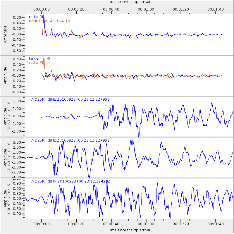
D25K Kavik River, AK, USA - Earthquake Result Viewer
*The percent match for this event was below the threshold and hence no stack was calculated.
| Earthquake location: |
Off East Coast Of Honshu, Japan |
| Earthquake latitude/longitude: |
34.5/141.7 |
| Earthquake time(UTC): |
2016/09/23 (267) 00:14:33 GMT |
| Earthquake Depth: |
10 km |
| Earthquake Magnitude: |
6.4 MWP, 6.3 MWW |
| Earthquake Catalog/Contributor: |
NEIC PDE/NEIC COMCAT |
|
| Network: |
TA USArray Transportable Network (new EarthScope stations) |
| Station: |
D25K Kavik River, AK, USA |
| Lat/Lon: |
69.32 N/146.38 W |
| Elevation: |
770 m |
|
| Distance: |
51.8 deg |
| Az: |
25.437 deg |
| Baz: |
267.092 deg |
| Ray Param: |
$rayparam |
*The percent match for this event was below the threshold and hence was not used in the summary stack. |
|
| Radial Match: |
96.02177 % |
| Radial Bump: |
369 |
| Transverse Match: |
88.37408 % |
| Transverse Bump: |
400 |
| SOD ConfigId: |
11737051 |
| Insert Time: |
2019-04-25 14:12:17.920 +0000 |
| GWidth: |
2.5 |
| Max Bumps: |
400 |
| Tol: |
0.001 |
|
Signal To Noise
| Channel | StoN | STA | LTA |
| TA:D25K: :BHZ:20160923T00:23:12.22499Z | 5.9506617 | 4.3277817E-7 | 7.272774E-8 |
| TA:D25K: :BHN:20160923T00:23:12.22499Z | 1.7404593 | 1.87815E-7 | 1.0791117E-7 |
| TA:D25K: :BHE:20160923T00:23:12.22499Z | 2.3961568 | 2.7235805E-7 | 1.1366454E-7 |
| Arrivals |
| Ps | |
| PpPs | |
| PsPs/PpSs | |


