You are here: Home > Network List > TA - USArray Transportable Network (new EarthScope stations) Stations List
> Station J20K Nowitna River, AK, USA > Earthquake Result Viewer
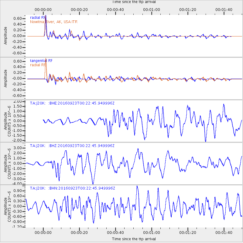
J20K Nowitna River, AK, USA - Earthquake Result Viewer
*The percent match for this event was below the threshold and hence no stack was calculated.
| Earthquake location: |
Off East Coast Of Honshu, Japan |
| Earthquake latitude/longitude: |
34.5/141.7 |
| Earthquake time(UTC): |
2016/09/23 (267) 00:14:33 GMT |
| Earthquake Depth: |
10 km |
| Earthquake Magnitude: |
6.4 MWP, 6.3 MWW |
| Earthquake Catalog/Contributor: |
NEIC PDE/NEIC COMCAT |
|
| Network: |
TA USArray Transportable Network (new EarthScope stations) |
| Station: |
J20K Nowitna River, AK, USA |
| Lat/Lon: |
64.18 N/154.15 W |
| Elevation: |
314 m |
|
| Distance: |
48.3 deg |
| Az: |
31.833 deg |
| Baz: |
264.059 deg |
| Ray Param: |
$rayparam |
*The percent match for this event was below the threshold and hence was not used in the summary stack. |
|
| Radial Match: |
93.272865 % |
| Radial Bump: |
400 |
| Transverse Match: |
73.91331 % |
| Transverse Bump: |
400 |
| SOD ConfigId: |
11737051 |
| Insert Time: |
2019-04-25 14:12:40.425 +0000 |
| GWidth: |
2.5 |
| Max Bumps: |
400 |
| Tol: |
0.001 |
|
Signal To Noise
| Channel | StoN | STA | LTA |
| TA:J20K: :BHZ:20160923T00:22:45.949996Z | 1.7226957 | 3.151795E-7 | 1.8295717E-7 |
| TA:J20K: :BHN:20160923T00:22:45.949996Z | 0.7860058 | 1.966175E-7 | 2.5014765E-7 |
| TA:J20K: :BHE:20160923T00:22:45.949996Z | 1.6119449 | 2.5060325E-7 | 1.5546638E-7 |
| Arrivals |
| Ps | |
| PpPs | |
| PsPs/PpSs | |


