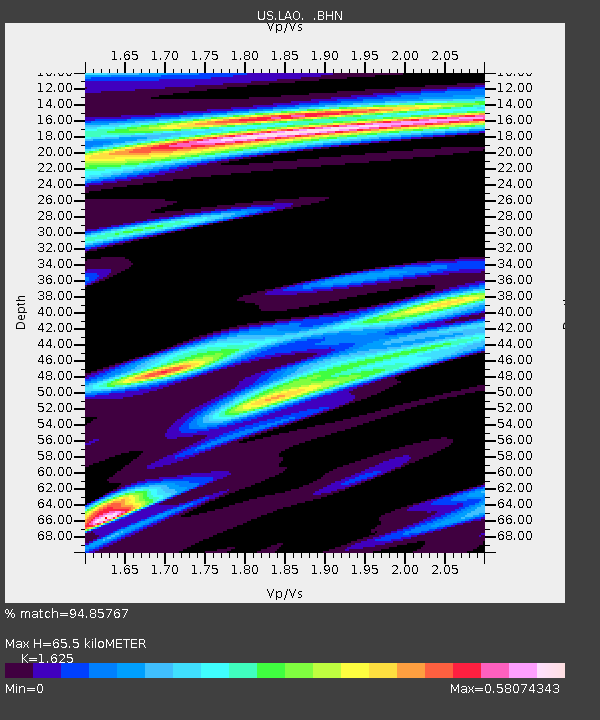
LAO LASA Array, Montana, USA - Earthquake Result Viewer

Earthquake location: Off East Coast Of Honshu, Japan
Earthquake latitude/longitude: 38.1/144.9
Earthquake time(UTC): 2005/11/14 (318) 21:38:51 GMT
Earthquake Depth: 11 km
Earthquake Magnitude: 6.7 MB, 6.8 MS, 7.0 MW, 6.9 MW
Earthquake Catalog/Contributor: WHDF/NEIC
Network: US United States National Seismic Network
Station: LAO LASA Array, Montana, USA
Lat/Lon: 46.69 N/106.22 W
Elevation: 902 m
Distance: 74.3 deg
Az: 42.57 deg
Baz: 309.175 deg
Ray Param: 0.052401453
Estimated Moho Depth: 65.5 km
Estimated Crust Vp/Vs: 1.62
Assumed Crust Vp: 6.438 km/s
Estimated Crust Vs: 3.962 km/s
Estimated Crust Poisson's Ratio: 0.20
Radial Match: 94.85767 %
Radial Bump: 400
Transverse Match: 89.083466 %
Transverse Bump: 400
SOD ConfigId: 2448
Insert Time: 2010-03-05 07:11:14.497 +0000
GWidth: 2.5
Max Bumps: 400
Tol: 0.001

Signal To Noise

ChannelStoNSTALTA
US:LAO: :BHN:20051114T21:49:57.542009Z0.57847635.134635E-78.876136E-7
US:LAO: :BHE:20051114T21:49:57.542009Z1.39210847.2321353E-75.195095E-7
US:LAO: :BHZ:20051114T21:49:57.542009Z21.9544285.335899E-62.4304433E-7
Arrivals
Ps6.6 SECOND
PpPs26 SECOND
PsPs/PpSs32 SECOND