You are here: Home > Network List > WY - Yellowstone Wyoming Seismic Network Stations List
> Station YHH Holmes Hill, YNP, WY, USA > Earthquake Result Viewer
YHH Holmes Hill, YNP, WY, USA - Earthquake Result Viewer
*The percent match for this event was below the threshold and hence no stack was calculated.
| Earthquake location: |
Solomon Islands |
| Earthquake latitude/longitude: |
-10.1/160.5 |
| Earthquake time(UTC): |
2015/09/24 (267) 15:56:57 GMT |
| Earthquake Depth: |
23 km |
| Earthquake Magnitude: |
6.0 MB |
| Earthquake Catalog/Contributor: |
NEIC PDE/NEIC COMCAT |
|
| Network: |
WY Yellowstone Wyoming Seismic Network |
| Station: |
YHH Holmes Hill, YNP, WY, USA |
| Lat/Lon: |
44.79 N/110.85 W |
| Elevation: |
2717 m |
|
| Distance: |
96.1 deg |
| Az: |
45.721 deg |
| Baz: |
261.856 deg |
| Ray Param: |
$rayparam |
*The percent match for this event was below the threshold and hence was not used in the summary stack. |
|
| Radial Match: |
61.662533 % |
| Radial Bump: |
365 |
| Transverse Match: |
60.059624 % |
| Transverse Bump: |
400 |
| SOD ConfigId: |
1156111 |
| Insert Time: |
2015-10-08 16:34:41.473 +0000 |
| GWidth: |
2.5 |
| Max Bumps: |
400 |
| Tol: |
0.001 |
|
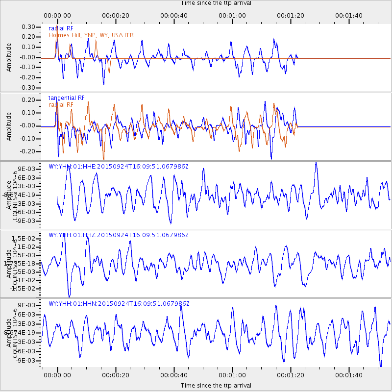
Signal To Noise
| Channel | StoN | STA | LTA |
| WY:YHH:01:HHZ:20150924T16:09:51.067986Z | 2.4521952 | 1.065397E-8 | 4.3446664E-9 |
| WY:YHH:01:HHN:20150924T16:09:51.067986Z | 0.4342831 | 2.0639501E-9 | 4.7525455E-9 |
| WY:YHH:01:HHE:20150924T16:09:51.067986Z | 0.96297514 | 4.3588457E-9 | 4.5264366E-9 |
| Arrivals |
| Ps | |
| PpPs | |
| PsPs/PpSs | |


