LAO LASA Array, Montana, USA - Earthquake Result Viewer
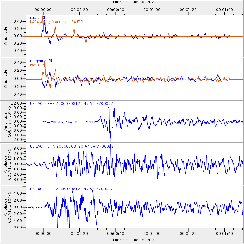
Earthquake location: Andreanof Islands, Aleutian Is.
Earthquake latitude/longitude: 51.2/-179.3
Earthquake time(UTC): 2006/07/08 (189) 20:40:00 GMT
Earthquake Depth: 22 km
Earthquake Magnitude: 6.2 MB, 6.4 MS, 6.6 MW, 6.6 MW
Earthquake Catalog/Contributor: WHDF/NEIC
Network: US United States National Seismic Network
Station: LAO LASA Array, Montana, USA
Lat/Lon: 46.69 N/106.22 W
Elevation: 902 m
Distance: 46.4 deg
Az: 65.473 deg
Baz: 303.776 deg
Ray Param: 0.070647806
Estimated Moho Depth: 43.25 km
Estimated Crust Vp/Vs: 1.95
Assumed Crust Vp: 6.438 km/s
Estimated Crust Vs: 3.297 km/s
Estimated Crust Poisson's Ratio: 0.32
Radial Match: 91.654884 %
Radial Bump: 400
Transverse Match: 89.93504 %
Transverse Bump: 400
SOD ConfigId: 5423
Insert Time: 2010-03-05 07:11:47.238 +0000
GWidth: 2.5
Max Bumps: 400
Tol: 0.001

Signal To Noise

ChannelStoNSTALTA
US:LAO: :BHN:20060708T20:47:54.770009Z1.49467644.1748456E-72.7931435E-7
US:LAO: :BHE:20060708T20:47:54.770009Z4.19480137.9868715E-71.9039928E-7
US:LAO: :BHZ:20060708T20:47:54.770009Z11.7592551.8223111E-61.5496823E-7
Arrivals
Ps6.8 SECOND
PpPs19 SECOND
PsPs/PpSs26 SECOND