You are here: Home > Network List > GS - US Geological Survey Networks Stations List
> Station KAN11 Stewart Ranch, Harper County, KS, USA > Earthquake Result Viewer
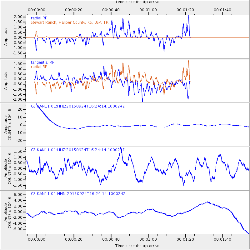
KAN11 Stewart Ranch, Harper County, KS, USA - Earthquake Result Viewer
*The percent match for this event was below the threshold and hence no stack was calculated.
| Earthquake location: |
Near Coast Of Central Chile |
| Earthquake latitude/longitude: |
-30.7/-71.4 |
| Earthquake time(UTC): |
2015/09/24 (267) 16:13:24 GMT |
| Earthquake Depth: |
32 km |
| Earthquake Magnitude: |
5.6 MB |
| Earthquake Catalog/Contributor: |
NEIC PDE/NEIC ALERT |
|
| Network: |
GS US Geological Survey Networks |
| Station: |
KAN11 Stewart Ranch, Harper County, KS, USA |
| Lat/Lon: |
37.21 N/97.91 W |
| Elevation: |
410 m |
|
| Distance: |
72.0 deg |
| Az: |
337.954 deg |
| Baz: |
156.109 deg |
| Ray Param: |
$rayparam |
*The percent match for this event was below the threshold and hence was not used in the summary stack. |
|
| Radial Match: |
41.04895 % |
| Radial Bump: |
400 |
| Transverse Match: |
38.053745 % |
| Transverse Bump: |
400 |
| SOD ConfigId: |
1156111 |
| Insert Time: |
2015-10-08 16:39:02.773 +0000 |
| GWidth: |
2.5 |
| Max Bumps: |
400 |
| Tol: |
0.001 |
|
Signal To Noise
| Channel | StoN | STA | LTA |
| GS:KAN11:01:HHZ:20150924T16:24:14.100024Z | 0.87398106 | 3.676401E-7 | 4.2064997E-7 |
| GS:KAN11:01:HHN:20150924T16:24:14.100024Z | 0.2427274 | 6.100257E-7 | 2.513213E-6 |
| GS:KAN11:01:HHE:20150924T16:24:14.100024Z | 0.54819995 | 5.0910025E-6 | 9.286762E-6 |
| Arrivals |
| Ps | |
| PpPs | |
| PsPs/PpSs | |


