You are here: Home > Network List > US - United States National Seismic Network Stations List
> Station LAO LASA Array, Montana, USA > Earthquake Result Viewer
LAO LASA Array, Montana, USA - Earthquake Result Viewer
*The percent match for this event was below the threshold and hence no stack was calculated.
| Earthquake location: |
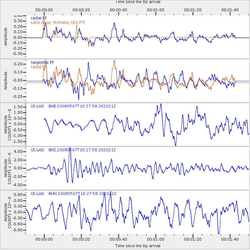
Near East Coast Of Honshu, Japan |
| Earthquake latitude/longitude: |
36.2/141.8 |
| Earthquake time(UTC): |
2008/05/07 (128) 16:16:36 GMT |
| Earthquake Depth: |
23 km |
| Earthquake Magnitude: |
5.9 MB, 6.1 MW, 6.0 MW |
| Earthquake Catalog/Contributor: |
WHDF/NEIC |
|
| Network: |
US United States National Seismic Network |
| Station: |
LAO LASA Array, Montana, USA |
| Lat/Lon: |
46.69 N/106.22 W |
| Elevation: |
902 m |
|
| Distance: |
77.5 deg |
| Az: |
40.827 deg |
| Baz: |
309.772 deg |
| Ray Param: |
$rayparam |
*The percent match for this event was below the threshold and hence was not used in the summary stack. |
|
| Radial Match: |
51.40641 % |
| Radial Bump: |
400 |
| Transverse Match: |
52.79529 % |
| Transverse Bump: |
400 |
| SOD ConfigId: |
2504 |
| Insert Time: |
2010-03-05 07:12:29.188 +0000 |
| GWidth: |
2.5 |
| Max Bumps: |
400 |
| Tol: |
0.001 |
|
Signal To Noise
| Channel | StoN | STA | LTA |
| US:LAO: :BHZ:20080507T16:27:58.262021Z | 3.5480819 | 6.5592764E-7 | 1.8486824E-7 |
| US:LAO: :BHN:20080507T16:27:58.262021Z | 0.9975871 | 2.990003E-7 | 2.9972352E-7 |
| US:LAO: :BHE:20080507T16:27:58.262021Z | 1.4322951 | 4.0087926E-7 | 2.7988594E-7 |
| Arrivals |
| Ps | |
| PpPs | |
| PsPs/PpSs | |


