You are here: Home > Network List > US - United States National Seismic Network Stations List
> Station LAO LASA Array, Montana, USA > Earthquake Result Viewer
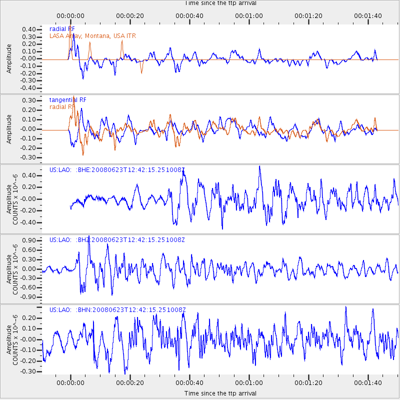
LAO LASA Array, Montana, USA - Earthquake Result Viewer
*The percent match for this event was below the threshold and hence no stack was calculated.
| Earthquake location: |
Kuril Islands |
| Earthquake latitude/longitude: |
46.5/153.3 |
| Earthquake time(UTC): |
2008/06/23 (175) 12:32:12 GMT |
| Earthquake Depth: |
10 km |
| Earthquake Magnitude: |
5.6 MB, 5.2 MS, 5.6 MW, 5.6 MW |
| Earthquake Catalog/Contributor: |
WHDF/NEIC |
|
| Network: |
US United States National Seismic Network |
| Station: |
LAO LASA Array, Montana, USA |
| Lat/Lon: |
46.69 N/106.22 W |
| Elevation: |
902 m |
|
| Distance: |
64.1 deg |
| Az: |
48.827 deg |
| Baz: |
310.924 deg |
| Ray Param: |
$rayparam |
*The percent match for this event was below the threshold and hence was not used in the summary stack. |
|
| Radial Match: |
66.5414 % |
| Radial Bump: |
400 |
| Transverse Match: |
68.47673 % |
| Transverse Bump: |
400 |
| SOD ConfigId: |
2504 |
| Insert Time: |
2010-03-05 07:12:36.497 +0000 |
| GWidth: |
2.5 |
| Max Bumps: |
400 |
| Tol: |
0.001 |
|
Signal To Noise
| Channel | StoN | STA | LTA |
| US:LAO: :BHZ:20080623T12:42:15.251008Z | 4.7309537 | 3.6569458E-7 | 7.7298274E-8 |
| US:LAO: :BHN:20080623T12:42:15.251008Z | 0.38942212 | 6.2864956E-8 | 1.6143139E-7 |
| US:LAO: :BHE:20080623T12:42:15.251008Z | 1.7699224 | 1.4213745E-7 | 8.0307174E-8 |
| Arrivals |
| Ps | |
| PpPs | |
| PsPs/PpSs | |


