You are here: Home > Network List > TA - USArray Transportable Network (new EarthScope stations) Stations List
> Station O17K Koliganek, Bristol Bay, AK, USA > Earthquake Result Viewer
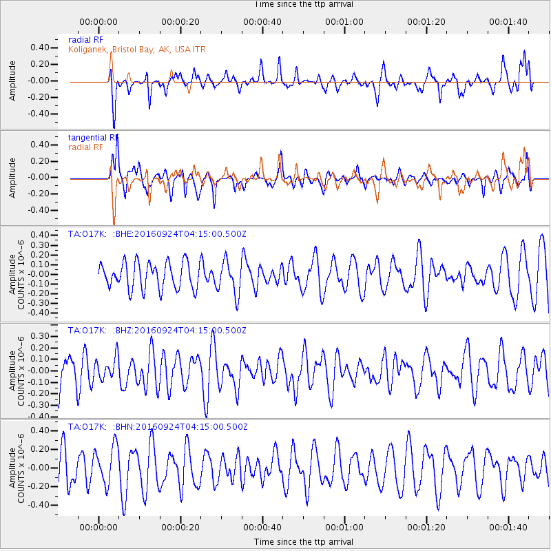
O17K Koliganek, Bristol Bay, AK, USA - Earthquake Result Viewer
*The percent match for this event was below the threshold and hence no stack was calculated.
| Earthquake location: |
South Of Kermadec Islands |
| Earthquake latitude/longitude: |
-32.6/-177.6 |
| Earthquake time(UTC): |
2016/09/24 (268) 04:02:13 GMT |
| Earthquake Depth: |
10 km |
| Earthquake Magnitude: |
5.8 MO |
| Earthquake Catalog/Contributor: |
NEIC PDE/NEIC ALERT |
|
| Network: |
TA USArray Transportable Network (new EarthScope stations) |
| Station: |
O17K Koliganek, Bristol Bay, AK, USA |
| Lat/Lon: |
59.77 N/157.09 W |
| Elevation: |
156 m |
|
| Distance: |
93.5 deg |
| Az: |
10.208 deg |
| Baz: |
197.208 deg |
| Ray Param: |
$rayparam |
*The percent match for this event was below the threshold and hence was not used in the summary stack. |
|
| Radial Match: |
52.283356 % |
| Radial Bump: |
400 |
| Transverse Match: |
58.236134 % |
| Transverse Bump: |
322 |
| SOD ConfigId: |
11737051 |
| Insert Time: |
2019-04-25 14:38:04.267 +0000 |
| GWidth: |
2.5 |
| Max Bumps: |
400 |
| Tol: |
0.001 |
|
Signal To Noise
| Channel | StoN | STA | LTA |
| TA:O17K: :BHZ:20160924T04:15:00.500Z | 0.54295456 | 9.92141E-8 | 1.8273002E-7 |
| TA:O17K: :BHN:20160924T04:15:00.500Z | 1.3015265 | 2.1209345E-7 | 1.6295745E-7 |
| TA:O17K: :BHE:20160924T04:15:00.500Z | 0.87020755 | 1.1476677E-7 | 1.3188436E-7 |
| Arrivals |
| Ps | |
| PpPs | |
| PsPs/PpSs | |


