You are here: Home > Network List > US - United States National Seismic Network Stations List
> Station HAWA Hanford, Washington, USA > Earthquake Result Viewer
HAWA Hanford, Washington, USA - Earthquake Result Viewer
*The percent match for this event was below the threshold and hence no stack was calculated.
| Earthquake location: |
Near Coast Of Central Chile |
| Earthquake latitude/longitude: |
-30.7/-71.4 |
| Earthquake time(UTC): |
2015/09/24 (267) 16:13:24 GMT |
| Earthquake Depth: |
32 km |
| Earthquake Magnitude: |
5.6 MB |
| Earthquake Catalog/Contributor: |
NEIC PDE/NEIC ALERT |
|
| Network: |
US United States National Seismic Network |
| Station: |
HAWA Hanford, Washington, USA |
| Lat/Lon: |
46.39 N/119.53 W |
| Elevation: |
364 m |
|
| Distance: |
88.2 deg |
| Az: |
328.935 deg |
| Baz: |
140.041 deg |
| Ray Param: |
$rayparam |
*The percent match for this event was below the threshold and hence was not used in the summary stack. |
|
| Radial Match: |
23.81122 % |
| Radial Bump: |
259 |
| Transverse Match: |
51.24453 % |
| Transverse Bump: |
284 |
| SOD ConfigId: |
1156111 |
| Insert Time: |
2015-10-08 16:43:25.412 +0000 |
| GWidth: |
2.5 |
| Max Bumps: |
400 |
| Tol: |
0.001 |
|
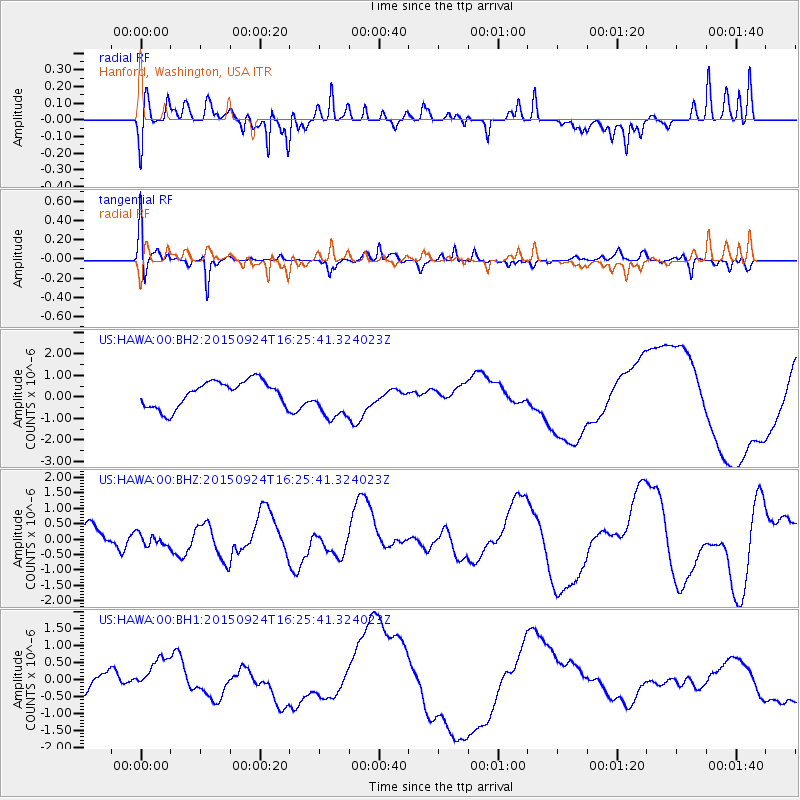
Signal To Noise
| Channel | StoN | STA | LTA |
| US:HAWA:00:BHZ:20150924T16:25:41.324023Z | 0.5352807 | 2.2212092E-7 | 4.1496153E-7 |
| US:HAWA:00:BH1:20150924T16:25:41.324023Z | 1.6227622 | 5.600096E-7 | 3.450965E-7 |
| US:HAWA:00:BH2:20150924T16:25:41.324023Z | 1.5954684 | 9.670586E-7 | 6.0612825E-7 |
| Arrivals |
| Ps | |
| PpPs | |
| PsPs/PpSs | |


