You are here: Home > Network List > US - United States National Seismic Network Stations List
> Station LAO LASA Array, Montana, USA > Earthquake Result Viewer
LAO LASA Array, Montana, USA - Earthquake Result Viewer
*The percent match for this event was below the threshold and hence no stack was calculated.
| Earthquake location: |
Southern Peru |
| Earthquake latitude/longitude: |
-15.1/-70.2 |
| Earthquake time(UTC): |
2009/09/05 (248) 03:58:39 GMT |
| Earthquake Depth: |
210 km |
| Earthquake Magnitude: |
5.8 MW, 5.2 MB, 5.8 MW |
| Earthquake Catalog/Contributor: |
WHDF/NEIC |
|
| Network: |
US United States National Seismic Network |
| Station: |
LAO LASA Array, Montana, USA |
| Lat/Lon: |
46.69 N/106.22 W |
| Elevation: |
902 m |
|
| Distance: |
69.5 deg |
| Az: |
334.425 deg |
| Baz: |
142.723 deg |
| Ray Param: |
$rayparam |
*The percent match for this event was below the threshold and hence was not used in the summary stack. |
|
| Radial Match: |
57.061214 % |
| Radial Bump: |
400 |
| Transverse Match: |
60.31213 % |
| Transverse Bump: |
400 |
| SOD ConfigId: |
2622 |
| Insert Time: |
2010-03-05 07:12:59.896 +0000 |
| GWidth: |
2.5 |
| Max Bumps: |
400 |
| Tol: |
0.001 |
|
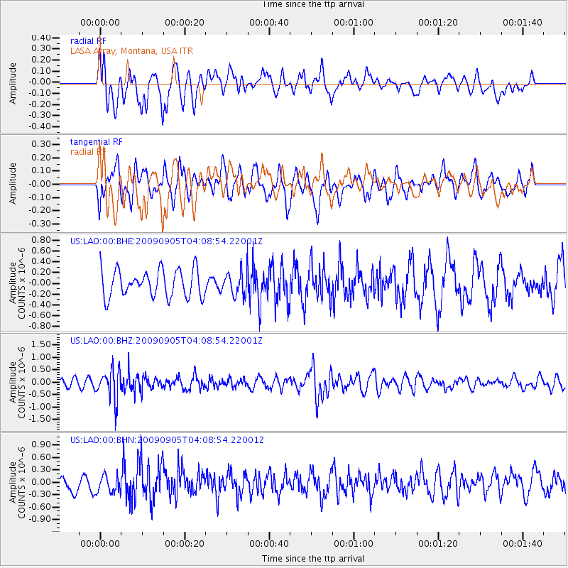
Signal To Noise
| Channel | StoN | STA | LTA |
| US:LAO:00:BHZ:20090905T04:08:54.22001Z | 3.7157123 | 6.092979E-7 | 1.6397877E-7 |
| US:LAO:00:BHN:20090905T04:08:54.22001Z | 0.7824002 | 2.0083739E-7 | 2.5669394E-7 |
| US:LAO:00:BHE:20090905T04:08:54.22001Z | 0.9110735 | 2.2862545E-7 | 2.5094073E-7 |
| Arrivals |
| Ps | |
| PpPs | |
| PsPs/PpSs | |


