You are here: Home > Network List > US - United States National Seismic Network Stations List
> Station LAO LASA Array, Montana, USA > Earthquake Result Viewer
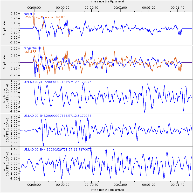
LAO LASA Array, Montana, USA - Earthquake Result Viewer
*The percent match for this event was below the threshold and hence no stack was calculated.
| Earthquake location: |
Samoa Islands Region |
| Earthquake latitude/longitude: |
-15.8/-172.6 |
| Earthquake time(UTC): |
2009/09/29 (272) 23:45:03 GMT |
| Earthquake Depth: |
10 km |
| Earthquake Magnitude: |
6.0 MB, 5.8 MS |
| Earthquake Catalog/Contributor: |
WHDF/NEIC |
|
| Network: |
US United States National Seismic Network |
| Station: |
LAO LASA Array, Montana, USA |
| Lat/Lon: |
46.69 N/106.22 W |
| Elevation: |
902 m |
|
| Distance: |
86.0 deg |
| Az: |
39.198 deg |
| Baz: |
242.09 deg |
| Ray Param: |
$rayparam |
*The percent match for this event was below the threshold and hence was not used in the summary stack. |
|
| Radial Match: |
63.698883 % |
| Radial Bump: |
400 |
| Transverse Match: |
69.637215 % |
| Transverse Bump: |
400 |
| SOD ConfigId: |
2622 |
| Insert Time: |
2010-03-05 07:13:03.587 +0000 |
| GWidth: |
2.5 |
| Max Bumps: |
400 |
| Tol: |
0.001 |
|
Signal To Noise
| Channel | StoN | STA | LTA |
| US:LAO:00:BHZ:20090929T23:57:12.517007Z | 1.2984565 | 4.1384374E-7 | 3.1871977E-7 |
| US:LAO:00:BHN:20090929T23:57:12.517007Z | 0.94974244 | 3.8343612E-7 | 4.037264E-7 |
| US:LAO:00:BHE:20090929T23:57:12.517007Z | 1.2432302 | 6.281772E-7 | 5.0527825E-7 |
| Arrivals |
| Ps | |
| PpPs | |
| PsPs/PpSs | |


