You are here: Home > Network List > TA - USArray Transportable Network (new EarthScope stations) Stations List
> Station J26L Joseph Creek, AK, USA > Earthquake Result Viewer
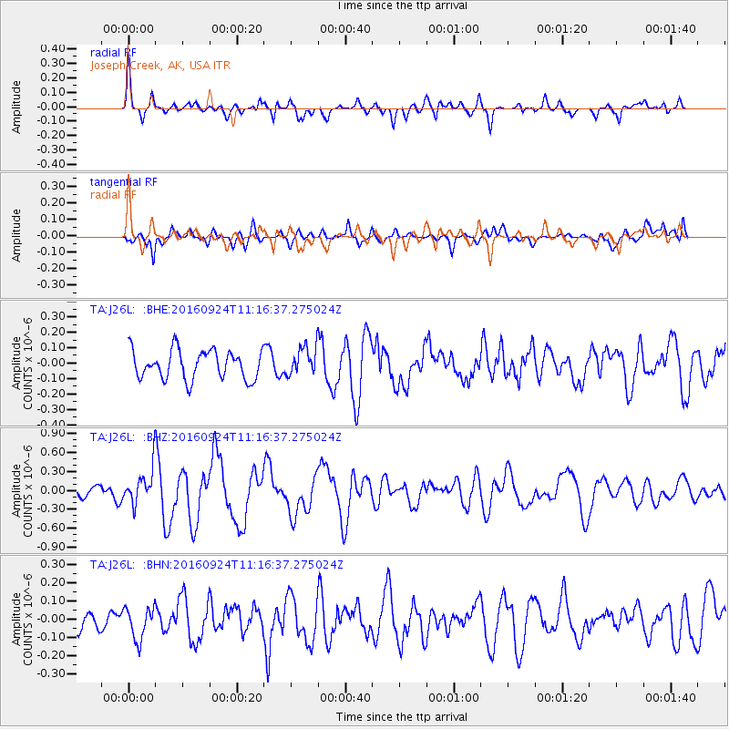
J26L Joseph Creek, AK, USA - Earthquake Result Viewer
*The percent match for this event was below the threshold and hence no stack was calculated.
| Earthquake location: |
Irian Jaya Region, Indonesia |
| Earthquake latitude/longitude: |
-1.9/140.6 |
| Earthquake time(UTC): |
2016/09/24 (268) 11:04:30 GMT |
| Earthquake Depth: |
10 km |
| Earthquake Magnitude: |
5.6 MB |
| Earthquake Catalog/Contributor: |
NEIC PDE/NEIC ALERT |
|
| Network: |
TA USArray Transportable Network (new EarthScope stations) |
| Station: |
J26L Joseph Creek, AK, USA |
| Lat/Lon: |
64.50 N/143.56 W |
| Elevation: |
1144 m |
|
| Distance: |
85.7 deg |
| Az: |
24.889 deg |
| Baz: |
256.35 deg |
| Ray Param: |
$rayparam |
*The percent match for this event was below the threshold and hence was not used in the summary stack. |
|
| Radial Match: |
76.04847 % |
| Radial Bump: |
400 |
| Transverse Match: |
60.49795 % |
| Transverse Bump: |
400 |
| SOD ConfigId: |
11737051 |
| Insert Time: |
2019-04-25 14:43:58.280 +0000 |
| GWidth: |
2.5 |
| Max Bumps: |
400 |
| Tol: |
0.001 |
|
Signal To Noise
| Channel | StoN | STA | LTA |
| TA:J26L: :BHZ:20160924T11:16:37.275024Z | 3.6756492 | 2.926897E-7 | 7.962939E-8 |
| TA:J26L: :BHN:20160924T11:16:37.275024Z | 1.095773 | 8.791306E-8 | 8.022926E-8 |
| TA:J26L: :BHE:20160924T11:16:37.275024Z | 1.0102154 | 9.404467E-8 | 9.309369E-8 |
| Arrivals |
| Ps | |
| PpPs | |
| PsPs/PpSs | |


