You are here: Home > Network List > US - United States National Seismic Network Stations List
> Station LAO LASA Array, Montana, USA > Earthquake Result Viewer
LAO LASA Array, Montana, USA - Earthquake Result Viewer
*The percent match for this event was below the threshold and hence no stack was calculated.
| Earthquake location: |
Southeast Of Easter Island |
| Earthquake latitude/longitude: |
-36.0/-102.7 |
| Earthquake time(UTC): |
2009/07/08 (189) 19:23:37 GMT |
| Earthquake Depth: |
12 km |
| Earthquake Magnitude: |
5.5 MS, 5.4 MB, 6.0 MW, 5.9 MW |
| Earthquake Catalog/Contributor: |
WHDF/NEIC |
|
| Network: |
US United States National Seismic Network |
| Station: |
LAO LASA Array, Montana, USA |
| Lat/Lon: |
46.69 N/106.22 W |
| Elevation: |
902 m |
|
| Distance: |
82.4 deg |
| Az: |
357.544 deg |
| Baz: |
177.107 deg |
| Ray Param: |
$rayparam |
*The percent match for this event was below the threshold and hence was not used in the summary stack. |
|
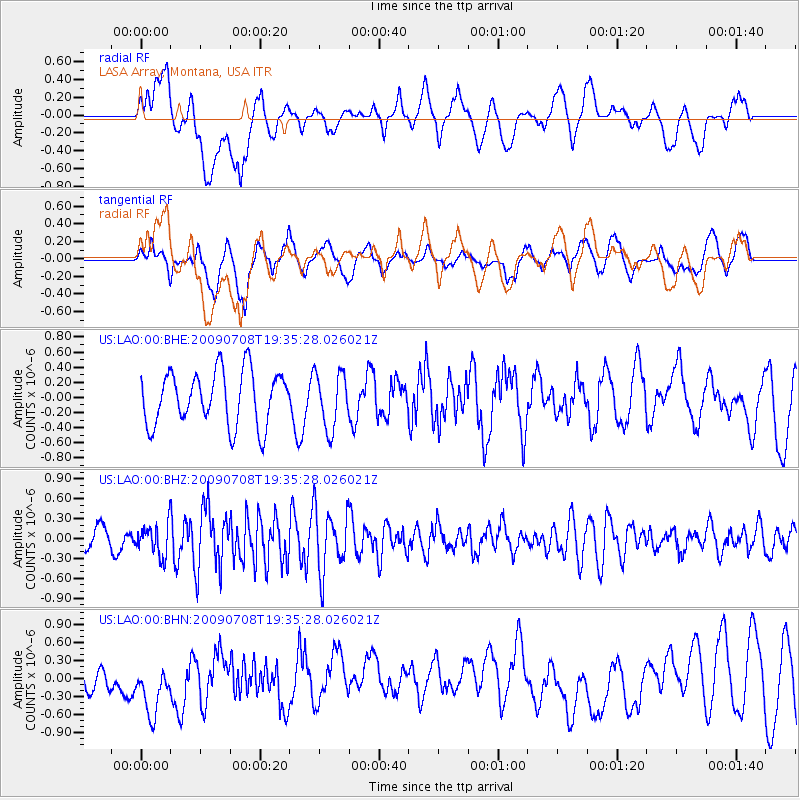
| Radial Match: |
56.4849 % |
| Radial Bump: |
400 |
| Transverse Match: |
61.064224 % |
| Transverse Bump: |
400 |
| SOD ConfigId: |
2648 |
| Insert Time: |
2010-03-05 07:13:36.045 +0000 |
| GWidth: |
2.5 |
| Max Bumps: |
400 |
| Tol: |
0.001 |
|
Signal To Noise
| Channel | StoN | STA | LTA |
| US:LAO:00:BHZ:20090708T19:35:28.026021Z | 1.5336863 | 2.3693792E-7 | 1.5448917E-7 |
| US:LAO:00:BHN:20090708T19:35:28.026021Z | 1.8925714 | 4.4733946E-7 | 2.3636596E-7 |
| US:LAO:00:BHE:20090708T19:35:28.026021Z | 1.0394093 | 3.6926258E-7 | 3.5526196E-7 |
| Arrivals |
| Ps | |
| PpPs | |
| PsPs/PpSs | |


