You are here: Home > Network List > US - United States National Seismic Network Stations List
> Station LAO LASA Array, Montana, USA > Earthquake Result Viewer
LAO LASA Array, Montana, USA - Earthquake Result Viewer
*The percent match for this event was below the threshold and hence no stack was calculated.
| Earthquake location: |
Chile-Bolivia Border Region |
| Earthquake latitude/longitude: |
-21.8/-67.1 |
| Earthquake time(UTC): |
2009/07/14 (195) 18:38:08 GMT |
| Earthquake Depth: |
176 km |
| Earthquake Magnitude: |
5.7 MW, 5.4 MB, 5.7 MW |
| Earthquake Catalog/Contributor: |
WHDF/NEIC |
|
| Network: |
US United States National Seismic Network |
| Station: |
LAO LASA Array, Montana, USA |
| Lat/Lon: |
46.69 N/106.22 W |
| Elevation: |
902 m |
|
| Distance: |
76.8 deg |
| Az: |
333.496 deg |
| Baz: |
142.961 deg |
| Ray Param: |
$rayparam |
*The percent match for this event was below the threshold and hence was not used in the summary stack. |
|
| Radial Match: |
53.806915 % |
| Radial Bump: |
400 |
| Transverse Match: |
52.872158 % |
| Transverse Bump: |
400 |
| SOD ConfigId: |
2648 |
| Insert Time: |
2010-03-05 07:13:37.519 +0000 |
| GWidth: |
2.5 |
| Max Bumps: |
400 |
| Tol: |
0.001 |
|
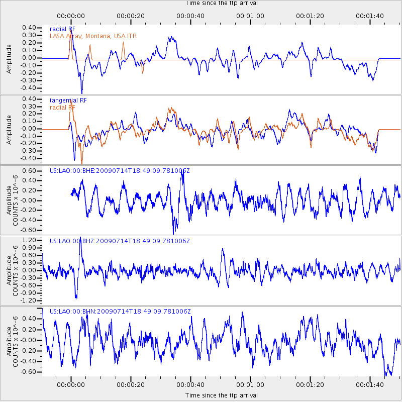
Signal To Noise
| Channel | StoN | STA | LTA |
| US:LAO:00:BHZ:20090714T18:49:09.781006Z | 3.734728 | 5.864282E-7 | 1.5702032E-7 |
| US:LAO:00:BHN:20090714T18:49:09.781006Z | 1.7429582 | 2.9659773E-7 | 1.7016917E-7 |
| US:LAO:00:BHE:20090714T18:49:09.781006Z | 1.2682595 | 2.3492672E-7 | 1.8523552E-7 |
| Arrivals |
| Ps | |
| PpPs | |
| PsPs/PpSs | |


